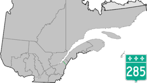
Quebec Route 285
Highway in Quebec
Route 285 | ||||
|---|---|---|---|---|
 | ||||
| Route information | ||||
| Length | 48 km[1] (30 mi) | |||
| Major junctions | ||||
| South end |  R-204 in Saint-Adalbert R-204 in Saint-Adalbert | |||
| North end |  R-132 in L'Islet R-132 in L'Islet | |||
| Location | ||||
| Country | Canada | |||
| Province | Quebec | |||
| Major cities | L'Islet | |||
| Highway system | ||||
| ||||
| ||||


Route 285 is a 48 km two-lane north/south highway on the south shore of the Saint Lawrence River in the Chaudière-Appalaches region of Quebec, Canada. Its northern terminus is in L'Islet at the junction of Route 132 and the southern terminus is close to Saint-Adalbert at the junction of Route 204.
Towns along Route 285
-
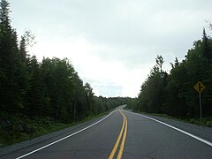 Quebec Route 285 near Saint-Adalbert.
 -
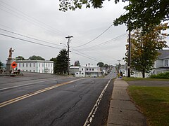 Route 285 in Saint-Cyrille-de-Lessard.
 -
 Route 285 south of Saint-Cyrille.


See also
References
- ^ Ministère des transports, "Distances routières", page (?), Les Publications du Québec, 2005
External links
- Provincial Route Map (Courtesy of the Quebec Ministry of Transportation) (in French)
- Route 285 on Google Maps
- v
- t
- e
 | This Quebec road, road transport or highway-related article is a stub. You can help Wikipedia by expanding it. |
- v
- t
- e


