Quebec Route 263
Highway in Quebec
 R-161 in Saint-Augustin-de-Woburn R-161 in Saint-Augustin-de-Woburn & Marston
  R-108 in Lambton
  R-112 in Disraeli
  R-216 in Saint-Fortunat
 R-116 / R-165 in Princeville
  R-162 in Sait-Rosaire
 R-226 in Sainte-Marie-de-Blandford
  R-132 east of Becancour R-132 east of Becancour
←  R-261 R-261 | →  R-265 R-265 |
Route 263 is a two-lane north/south highway on the south shore of the Saint Lawrence River in Quebec, Canada. Its northern terminus is in the city of Bécancour at the junction of Route 132, and the southern terminus is at the junction of Route 161 close to Saint-Augustin-de-Woburn.
List of towns along Route 263
- Sainte-Marie-de-Blandford
- Lemieux
- Saint-Louis-de-Blandford
- Princeville
- Saint-Norbert-d'Arthabaska
- Sainte-Hélène-de-Chester
- Saint-Fortunat
- Saint-Jacques-le-Majeur-de-Wolfestown
- Disraeli
- Sainte-Praxède
- Saint-Romain
- Lambton
- Saint-Sébastien
- Sainte-Cécile-de-Whitton
- Marston
- Piopolis
- Saint-Augustin-de-Woburn
-
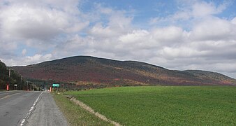
 View over Scotch Cap summit between Saint-Augustin-de-Woburn and Piopolis.
 -
 In Piopolis.
 -
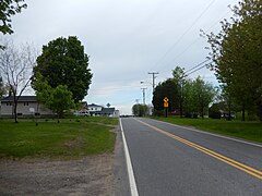
 In Marston.
 -
 Mont Sainte-Cécile in Sainte-Cécile-de-Whitton.
 -
 Morne de Saint-Sébastien in Saint-Sébastien.
 -
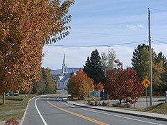
 Entering Lemieux.
 -
 Junction with Quebec Route 226 in Sainte-Marie-de-Blandford.


See also
References
- ^ Ministère des transports, "Distances routières", page (?), Les Publications du Québec, 2005
External links
- Route 263 on Google Maps
- Provincial Route Map (Courtesy of the Quebec Ministry of Transportation) (in French)
- v
- t
- e
 | This Quebec road, road transport or highway-related article is a stub. You can help Wikipedia by expanding it. |
- v
- t
- e


