San Gavino Monreale
Comune in Sardinia, Italy
San Gavino Monreale Santu ‘Engiu | |
|---|---|
Comune | |
| Comune di San Gavino Monreale | |
 | |
 Coat of arms | |
Location of San Gavino Monreale  | |
39°33′N 8°48′E / 39.550°N 8.800°E / 39.550; 8.800 | |
| Country | Italy |
| Region | Sardinia |
| Province | South Sardinia |
| Government | |
| • Mayor | Carlo Tomasi |
| Area | |
| • Total | 87.4 km2 (33.7 sq mi) |
| Elevation | 51 m (167 ft) |
| Population (31 December 2017)[1] | |
| • Total | 8,594 |
| • Density | 98/km2 (250/sq mi) |
| Demonym | Sangavinesi |
| Time zone | UTC+1 (CET) |
| • Summer (DST) | UTC+2 (CEST) |
| Postal code | 09037 |
| Dialing code | 070 |
| Patron saint | St. Clare |
| Saint day | August 12 |
| Website | Official website |
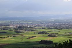
San Gavino Monreale (Sardinian: Santu ‘Engiu) is a comune (municipality) in the Province of South Sardinia in the Italian region Sardinia, located about 45 kilometres (28 mi) northwest of Cagliari, and roughly halfway between the latter and the town of Oristano.
San Gavino Monreale borders the following municipalities: Gonnosfanadiga, Pabillonis, Sanluri, Sardara, Villacidro. It is home to a castle.
History
The area of San Gavino was already settled in the Nuragic era, but the centre is of medieval origin. It was a possession of the Giudicato of Arborea and, later, of the Aragonese, being mostly destroyed in the ensuing war. Subsequently it was a fief of the Centelles and of the Osorio families, who held it until 1839.
People
- Fabio Aru, cyclist
- Raimondo Inconis, musician
External Sources
- San Gavino village school
References
Wikimedia Commons has media related to San Gavino Monreale.
- ^ All demographics and other statistics: Italian statistical institute Istat.
- v
- t
- e
- Arbus
- Armungia
- Ballao
- Barrali
- Barumini
- Buggerru
- Burcei
- Calasetta
- Carbonia
- Carloforte
- Castiadas
- Collinas
- Decimoputzu
- Dolianova
- Domus de Maria
- Domusnovas
- Donori
- Escalaplano
- Escolca
- Esterzili
- Fluminimaggiore
- Furtei
- Genoni
- Genuri
- Gergei
- Gesico
- Gesturi
- Giba
- Goni
- Gonnesa
- Gonnosfanadiga
- Guamaggiore
- Guasila
- Guspini
- Iglesias
- Isili
- Las Plassas
- Lunamatrona
- Mandas
- Masainas
- Monastir
- Muravera
- Musei
- Narcao
- Nuragus
- Nurallao
- Nuraminis
- Nurri
- Nuxis
- Orroli
- Ortacesus
- Pabillonis
- Pauli Arbarei
- Perdaxius
- Pimentel
- Piscinas
- Portoscuso
- Sadali, Sardinia
- Samassi
- Samatzai
- San Basilio
- San Gavino Monreale
- San Giovanni Suergiu
- San Nicolò Gerrei
- San Sperate
- San Vito
- Sanluri
- Santadi
- Sant'Andrea Frius
- Sant'Anna Arresi
- Sant'Antioco
- Sardara
- Segariu
- Selegas
- Senorbì
- Serdiana
- Serramanna
- Serrenti
- Serri
- Setzu
- Seui
- Seulo
- Siddi
- Siliqua
- Silius
- Siurgus Donigala
- Soleminis
- Suelli
- Teulada
- Tratalias
- Tuili
- Turri
- Ussana
- Ussaramanna
- Vallermosa
- Villacidro
- Villamar
- Villamassargia
- Villanova Tulo
- Villanovaforru
- Villanovafranca
- Villaperuccio
- Villaputzu
- Villasalto
- Villasimius
- Villasor
- Villaspeciosa
External links
- San Gavino Monreale . Net Italian website dedicated to San Gavino Monreale
Authority control databases | |
|---|---|
| International |
|
| Geographic |
|
 | This Sardinia location article is a stub. You can help Wikipedia by expanding it. |
- v
- t
- e


