Harirampur Upazila
Administrative region in Dhaka Division, Bangladesh
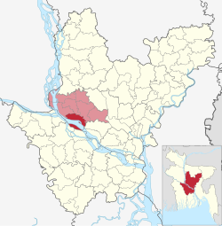
Upazila in Dhaka, Bangladesh
Harirampur হরিরামপুর | |
|---|---|
Upazila | |
 Machain Shahi Jami Mosque | |
 | |
| Coordinates: 23°44′N 89°58′E / 23.733°N 89.967°E / 23.733; 89.967 | |
| Country |  Bangladesh Bangladesh |
| Division | Dhaka |
| District | Manikganj |
| Government | |
| Area | |
| • Total | 245.42 km2 (94.76 sq mi) |
| Population (2011) | |
| • Total | 139,318 |
| • Density | 570/km2 (1,500/sq mi) |
| Time zone | UTC+6 (BST) |
| Website | Official Map of Harirampur |
Harirampur (Bengali: হরিরামপুর) is an upazila of Manikganj District in the Division of Dhaka, Bangladesh.[1]
Geography
Harirampur is located at 23°44′00″N 89°58′00″E / 23.7333°N 89.9667°E / 23.7333; 89.9667. It has 33,513 households and a total area of 245.42 km2.
Demographics
| Religions in Harirampur upazila (2011)[2] | ||||
|---|---|---|---|---|
| Religion | Percent | |||
| Islam | 88.43% | |||
| Hinduism | 11.56% | |||
| Other or not stated | 0.01% | |||
According to the 2011 Bangladesh census, Harirampur Upazila had 33,513 households and a population of 139,318. 29,438 (21.13%) were under 10 years of age. Harirampur had a literacy rate (age 7 and over) of 48.39%, compared to the national average of 51.8%, and a sex ratio of 1117 females per 1000 males. 2,244 (1.61%) lived in urban areas.[2][3]
According to the 2001 Bangladesh census, Harirampur had a population of 171,274. Males constituted 84,994, and females 86,280.[4] The population of those aged 18 and older was 115,752. Harirampur had an average literacy rate of 30.2% (7+ years), against the national average of 32.4%.[5]
Administration
Harirampur Upazila is divided into 13 union parishads:
- Azimnagar
- Balara
- Balla
- Boyra
- Chala
- Dhulsunra
- Gala
- Gopinathpur
- Harukandi
- Kanchanpur
- Lesraganj
- Ramkrishnapur
- Sutalari
The union parishads are subdivided into 196 mauzas and 250 villages.[6]
Education
Colleges
- Jhitka Khawja Rahamat Ali Degree College
- M.A. Rouf Degree College, Kowri
- Government Justice Nurul Islam College
Secondary Schools
- Ibrahimpur Ishwar Chandra High School
- Jhitka Anando Mohan High School
- Jhitka Pilot Girls High School
- Patgram Anath Bandhu Government High School
- Diabari High School
- Jatrapur High School
- Ramkrishnapur M A Jalil High School
- Mohiuddin Kamol High School
Primary Schools
- Dorikandi Government Primary School
- Adhermanik Model Government Primary School
- Balurchar Government Primary School
- Bhatikandi Government Primary School
- Sutalori Government Primary School
See also
References
- ^ Manoranjan Mandal (2012), "Harirampur Upazila", in Sirajul Islam and Ahmed A. Jamal (ed.), Banglapedia: National Encyclopedia of Bangladesh (Second ed.), Asiatic Society of Bangladesh
- ^ a b "Bangladesh Population and Housing Census 2011 Zila Report – Manikganj" (PDF). bbs.gov.bd. Bangladesh Bureau of Statistics.
- ^ "Community Tables: Manikganj district" (PDF). bbs.gov.bd. 2011.
- ^ "Bangladesh Population Index". Population Census Wing, BBS. BGD Government. Retrieved 16 August 2013.
- ^ "Population Census Wing, BBS". Archived from the original on 2005-03-27. Retrieved November 10, 2006.
- ^ "District Statistics 2011: Manikganj" (PDF). Bangladesh Bureau of Statistics. Archived from the original (PDF) on 13 November 2014. Retrieved 14 July 2014.


 | This Dhaka Division location article is a stub. You can help Wikipedia by expanding it. |
- v
- t
- e


