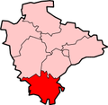
South Hams
Niet-metropolitaans district in Engeland  | |||
|---|---|---|---|
  | |||
| Situering | |||
| Land | Engeland | ||
| County | Devon | ||
| Regio | South West England | ||
| Coördinaten | 50°25'53"NB, 3°41'28"WL | ||
| Algemeen | |||
| Oppervlakte | 886,4851[1] km² | ||
| Inwoners (2018[2]) | 86.221 (97 inw./km²) | ||
| ONS-code | E07000044 | ||
| Website | Officiële website | ||
| Detailkaart | |||
 | |||
| Foto's | |||
 | |||
| |||

South Hams is een Engels district in het shire-graafschap (non-metropolitan county OF county) Devon en telt 81.849 inwoners. De oppervlakte bedraagt 886 km².
Van de bevolking is 20,8% ouder dan 65 jaar. De werkloosheid bedraagt 2,3% van de beroepsbevolking (cijfers volkstelling 2001).
Civil parishes in district South Hams
Ashprington, Aveton Gifford, Berry Pomeroy, Bickleigh, Bigbury, Blackawton, Brixton, Buckland-Tout-Saints, Charleton, Chivelstone, Churchstow, Cornwood, Cornworthy, Dartington, Dartmouth, Dean Prior, Diptford, Dittisham, East Allington, East Portlemouth, Ermington, Frogmore and Sherford, Halwell and Moreleigh, Harberton, Harford, Holbeton, Holne, Ivybridge, Kingsbridge, Kingston, Kingswear, Littlehempston, Loddiswell, Malborough, Marldon, Modbury, Newton and Noss, North Huish, Rattery, Ringmore, Salcombe, Shaugh Prior, Slapton, South Brent, South Huish, South Milton, South Pool, Sparkwell, Staverton, Stoke Fleming, Stoke Gabriel, Stokenham, Strete, Thurlestone, Totnes, Ugborough, Wembury, West Alvington, West Buckfastleigh, Woodleigh, Yealmpton.
Bronnen, noten en/of referenties
- ↑ Office for National Statistics → Download → SAM_for_Administrative_Areas_(2018).zip → SAM_LAD_DEC_2018_UK.xlsx.
- ↑ https://www.ons.gov.uk/file?uri=/peoplepopulationandcommunity/populationandmigration/populationestimates/datasets/populationestimatesforukenglandandwalesscotlandandnorthernireland/mid20182019laboundaries/ukmidyearestimates20182019ladcodes.xls Schatting Office for National Statistics: knop MYE5 → kolom Estimated Population mid-2018]
- Volkstelling 2001, Office for National Statistics


