Vihiga County
County in Kenya

Flag

Coat of arms
Location in Kenya
 Kenya
Kenya (2019)
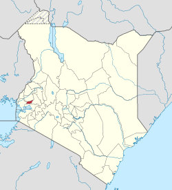
Vihiga County is an administrative region in the former Western Province of Kenya whose headquarters are in Mbale, the largest town in the county. The county has a population of 554,622[1] (2009 census) and an area of 563 km2.[2] Formerly a district, Vihiga was split from Kakamega District in 1990.[3] In 2019's census, Vihiga was found to have a population of 590,013, an increase of 35,391 from 2009's count.[4]
Religion
Religion in Vihiga County [5]
| Religion (2019 Census) | Number |
|---|---|
| Catholicism | 22,331 |
| Protestant | 201,738 |
| Evangelical Churches | 240,628 |
| African instituted Churches | 88,697 |
| Orthodox | 4,913 |
| Other Cristian | 13,469 |
| Islam | 5.796 |
| Hindu | 31 |
| Traditionists | 1,148 |
| Other | 4,639 |
| No ReligionAtheists | 3,337 |
| Don't Know | 389 |
| Not Stated | 73 |
| Authority | Type | Population* | Urban pop.* |
|---|---|---|---|
| Vihiga | Municipality | 98,189 | 19,067 |
| Luanda | Town | 68,157 | 8,757 |
| Vihiga county | County | 332,537 | 0 |
| * 1999 census. Source: [1][permanent dead link] | |||
Administrative divisions
| Division | Population* | Urban pop.* | Headquarters |
|---|---|---|---|
| Emuhaya | 69,250 | 0 | |
| Luanda | 92,462 | 8.016 | Luanda, Kenya |
| Sabatia | 117,863 | 10.135 | |
| Tiriki East | 59,943 | 0 | |
| Tiriki West | 76,370 | 0 | |
| Vihiga | 82,995 | 6.881 | Vihiga |
| * 1999 census. Sources: [2], [3], | |||
Constituencies
The district has five constituencies:
- Emuhaya Constituency
- Hamisi Constituency
- Sabatia Constituency
- Vihiga Constituency
- Luanda Constituency
Notable people
- Moses Mudavadi Cabinet minister
- Musalia Mudavadi Kenya's 7th Vice President of Kenya.
References
- ^ a b "Kenya Census 2009 | PDF | Census | Waste Management".
- ^ statoids.com – Districts of Kenya
- ^ Amutabi Lutta Mukhebi
- ^ "2019 Kenya Population and Housing Census Volume I: Population by County and Sub-County". Kenya National Bureau of Statistics. Retrieved 7 December 2019.
- ^ "2019 Kenya Population and Housing Census Volume IV: Distribution of Population by Socio-Economic Characteristics" (PDF). Kenya National Bureau of Statistics. Retrieved 2 May 2021.
External links
- Office for the Coordination of Humanitarian Affairs – Kenya AdminLevels 1-4 (.pdf)
- v
- t
- e
 First- and second-level administrative divisions of Kenya
(since March 2013)
- Baringo (30)
- Bomet (36)
- Bungoma (39)
- Busia (40)
- Elgeyo-Marakwet (28)
- Embu (14)
- Garissa (07)
- Homa Bay (43)
- Isiolo (11)
- Kajiado (34)
- Kakamega (37)
- Kericho (35)
- Kiambu (22)
- Kilifi (03)
- Kirinyaga (20)
- Kisii (45)
- Kisumu (42)
- Kitui (15)
- Kwale (02)
- Laikipia (31)
- Lamu (05)
- Machakos (16)
- Makueni (17)
- Mandera (09)
- Marsabit (10)
- Meru (12)
- Migori (44)
- Mombasa (01)
- Murang'a (21)
- Nairobi (47)
- Nakuru (32)
- Nandi (29)
- Narok (33)
- Nyamira (46)
- Nyandarua (18)
- Nyeri (19)
- Samburu (25)
- Siaya (41)
- Taita-Taveta (06)
- Tana River (04)
- Tharaka-Nithi (13)
- Trans-Nzoia (26)
- Turkana (23)
- Uasin Gishu (27)
- Vihiga (38)
- Wajir (08)
- West Pokot (24)
and towns
- Nairobi (capital)
- Athi River
- Baragoi
- Bomet
- Bungoma
- Busia
- Chuka
- Eldoret
- Embu
- Garissa
- Hola
- Homa Bay
- Isiolo
- Iten
- Kabarnet
- Kajiado
- Kakamega
- Kapsabet
- Kangundo - Tala
- Kapenguria
- Karuri
- Kericho
- Kerugoya
- Kiambu
- Kibwezi
- Kikuyu
- Kilifi
- Kisii
- Kisumu
- Kitale
- Kitengela
- Kitui
- Kwale
- Limuru
- Lodwar
- Lokichogio
- Loiyangalani
- Lamu
- Machakos
- Makindu
- Malindi
- Mandera
- Maralal
- Marsabit
- Masii
- Meru
- Mombasa
- Moyale
- Mtito Andei
- Mumias
- Murang'a
- Mutomo
- Mwingi
- Naivasha
- Nakuru
- Namanga
- Nanyuki
- Narok
- Nyahururu
- Nyamira
- Nyeri
- Ol Kalou
- Ongata Rongai
- Ruiru
- Siaya
- Thika
- Vihiga
- Voi
- Wajir
- Webuye
- Wote
- Wundanyi
0°4′N 34°40′E / 0.067°N 34.667°E / 0.067; 34.667
| Authority control databases |
|
|---|
 | This Western Province (Kenya) location article is a stub. You can help Wikipedia by expanding it. |
- v
- t
- e


