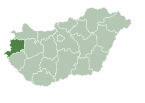
Vép
Place in Vas, Hungary

Flag

Coat of arms
 Hungary
 (2015)[1]
9751
Vép is a town in Vas county, Hungary.

External links
- Street map (in Hungarian)
References
- ^ Gazetteer of Hungary, 1st January 2015. Hungarian Central Statistical Office.
- v
- t
- e
Vas County
- Szombathely (county seat)


- Celldömölk
- Csepreg
- Bük
- Körmend
- Kőszeg
- Őriszentpéter
- Répcelak
- Sárvár
- Szentgotthárd
- Vasvár
- Vép
- Acsád
- Alsószölnök
- Alsóújlak
- Andrásfa
- Apátistvánfalva
- Bajánsenye
- Balogunyom
- Bejcgyertyános
- Bérbaltavár
- Bő
- Boba
- Bögöt
- Bögöte
- Borgáta
- Bozsok
- Bozzai
- Bucsu
- Cák
- Chernelházadamonya
- Csákánydoroszló
- Csánig
- Csehi
- Csehimindszent
- Csempeszkopács
- Csénye
- Csipkerek
- Csönge
- Csörötnek
- Daraboshegy
- Döbörhegy
- Döröske
- Dozmat
- Duka
- Egervölgy
- Egyházashetye
- Egyházashollós
- Egyházasrádóc
- Felsőcsatár
- Felsőjánosfa
- Felsőmarác
- Felsőszölnök
- Gasztony
- Gencsapáti
- Gersekarát
- Gérce
- Gór
- Gyanógeregye
- Gyöngyösfalu
- Győrvár
- Halastó
- Halogy
- Harasztifalu
- Hegyfalu
- Hegyháthodász
- Hegyhátsál
- Hegyhátszentjakab
- Hegyhátszentmárton
- Hegyhátszentpéter
- Horvátlövő
- Horvátzsidány
- Hosszúpereszteg
- Ikervár
- Iklanberény
- Ispánk
- Ivánc
- Ják
- Jákfa
- Jánosháza
- Karakó
- Katafa
- Káld
- Kám
- Keléd
- Kemeneskápolna
- Kemenesmagasi
- Kemenesmihályfa
- Kemenespálfa
- Kemenessömjén
- Kemenesszentmárton
- Kemestaródfa
- Kenéz
- Kenyeri
- Kercaszomor
- Kerkáskápolna
- Kétvölgy
- Kisrákos
- Kissomlyó
- Kisunyom
- Kiszsidány
- Köcsk
- Kondorfa
- Kőszegdoroszló
- Kőszegpaty
- Kőszegszerdahely
- Lócs
- Lukácsháza
- Magyarlak
- Magyarmádalja
- Magyarszecsőd
- Magyarszombatfa
- Meggyeskovácsi
- Megyehíd
- Mersevát
- Mesterháza
- Mesteri
- Meszlen
- Mikosszéplak
- Molnaszecsőd
- Nagygeresd
- Nagykölked
- Nagymizdó
- Nagyrákos
- Nagysimonyi
- Nagytilaj
- Nádasd
- Nárai
- Narda
- Nemesbőd
- Nemescsó
- Nemeskeresztúr
- Nemeskocs
- Nemeskolta
- Nemesládony
- Nemesmedves
- Nemesrempehollós
- Nick
- Nyőgér
- Olaszfa
- Ölbő
- Ólmod
- Orfalu
- Őrimagyarósd
- Ostffyasszonyfa
- Oszkó
- Pácsony
- Pankasz
- Pápoc
- Pecöl
- Perenye
- Peresznye
- Petőmihályfa
- Pinkamindszent
- Pornóapáti
- Porpác
- Pósfa
- Pusztacsó
- Püspökmolnári
- Rábagyarmat
- Rábahídvég
- Rábapaty
- Rábatöttös
- Rádóckölked
- Rátót
- Répceszentgyörgy
- Rönök
- Rum
- Sajtoskál
- Salköveskút
- Sárfimizdó
- Sé
- Simaság
- Sitke
- Söpte
- Sorkifalud
- Sorkikápolna
- Sorokpolány
- Sótony
- Szaknyér
- Szakonyfalu
- Szalafő
- Szarvaskend
- Szatta
- Szeleste
- Szemenye
- Szentpéterfa
- Szergény
- Szőce
- Tanakajd
- Táplánszentkereszt
- Telekes
- Tokorcs
- Tompaládony
- Tömörd
- Tormásliget
- Torony
- Uraiújfalu
- Vámoscsalád
- Vasalja
- Vásárosmiske
- Vasasszonyfa
- Vasegerszeg
- Vashosszúfalu
- Vaskeresztes
- Vassurány
- Vasszécseny
- Vasszentmihály
- Vasszilvágy
- Vát
- Velem
- Velemér
- Viszák
- Vönöck
- Zsédeny
- Zsennye
- History
- Geography
- Government
- Economy
- Culture
- Tourism
 | This Vas location article is a stub. You can help Wikipedia by expanding it. |
- v
- t
- e


