Tiszatenyő
Village in Jász-Nagykun-Szolnok, Hungary
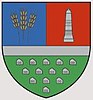
Coat of arms
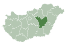
 Hungary
 (2015)
5082
Tiszatenyő is a village in Jász-Nagykun-Szolnok county, in the Northern Great Plain region of central Hungary.
Geography
It covers an area of 23.55 km2 (9 sq mi) and has a population of 1649 people (2015).[1] It's about 16 km (10 mi) far from Szolnok. It has a railway station in the 120 (Budapest East Railway Station-Szolnok-Békéscsaba-Arad) and the 130 (Szolnok-Tiszatenyő-Szentes-Makó) rail line. It has also a bus stop on the Törökszentmiklós-Martfű road.
References
- ^ a b Gazetteer of Hungary, 1st January 2015. Hungarian Central Statistical Office. 3 September 2015
External links
- Official site in Hungarian
- v
- t
- e
- Fegyvernek
- Törökszentmiklós (district seat)

- Kengyel
- Kuncsorba
- Örményes
- Tiszapüspöki
- Tiszatenyő
| ||
|---|---|---|
| City with county rights |
|   |
| Towns | ||
| Large villages | ||
| Villages |
| |
| Other topics |
| |
47°08′N 20°23′E / 47.133°N 20.383°E / 47.133; 20.383
 | This Jász-Nagykun-Szolnok location article is a stub. You can help Wikipedia by expanding it. |
- v
- t
- e


