Tijarafe
Municipality in Canary Islands, Spain

Flag

Seal

(2018)[2]
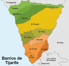
Tijarafe is a town and a municipality on the island of La Palma, Province of Santa Cruz de Tenerife, Canary Islands, Spain. It is situated in the northwestern part of the island. The population of the municipality is 2,776 (2013)[3] and the area is 53.76 km².[1] Tijarafe is 7 km northwest of Los Llanos de Aridane and 19 km west of the island capital Santa Cruz de La Palma.
The eastern border of the municipality is formed by the crater rim of the Caldera de Taburiente and its outflow, the Barranco de las Angustias.
Tijarafe was the name of one of the twelve old areas where the Guanches used to settle before the Spanish conquest. It corresponded with the present municipalities Tijarafe and Puntagorda.
Historical population
| Year | Population |
|---|---|
| 1991 | 2,195 |
| 1996 | 2,658 |
| 2001 | 2,730 |
| 2002 | 2,765 |
| 2003 | 2,687 |
| 2004 | 2,666 |
| 2008 | 2,757 |
| 2009 | 2,768 |
| 2013 | 2,776 |
See also
References
Places adjacent to Tijarafe | ||||||||||||||||
|---|---|---|---|---|---|---|---|---|---|---|---|---|---|---|---|---|
| ||||||||||||||||


- v
- t
- e
Municipalities in the province of Santa Cruz de Tenerife
- Adeje
- Arafo
- Arico
- Arona
- Buenavista del Norte
- Candelaria
- Fasnia
- Garachico
- Granadilla de Abona
- La Guancha
- Guía de Isora
- Güímar
- Icod de los Vinos
- La Matanza de Acentejo
- La Orotava
- Puerto de la Cruz
- Los Realejos
- El Rosario
- San Cristóbal de La Laguna
- San Juan de la Rambla
- San Miguel de Abona
- Santa Cruz de Tenerife
- Santa Úrsula
- Santiago del Teide
- El Sauzal
- Los Silos
- El Tanque
- Tacoronte
- Tegueste
- La Victoria de Acentejo
- Vilaflor

Authority control databases | |
|---|---|
| International |
|
| National |
|


