Sers, Hautes-Pyrénées
Commune in France
Commune in Occitania, France

Coat of arms
Location of Sers

42°53′17″N 0°02′21″E / 42.8881°N 0.0392°E / 42.8881; 0.0392
1
(2021)[1]
65424 /65120
(avg. 1,100 m or 3,600 ft)
Sers is a commune in the Hautes-Pyrénées department in south-western France.
See also
Gallery
-
 église Saint-Vincent
 -

-
 Fontaine 1616
 -
 Croix
Croix -
 Croix Saint-Justin
 -
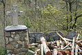
 Monument aux morts
 -
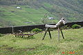 L'animal laboureur
 -
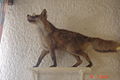 Le renard de Rozette


References
- ^ "Populations légales 2021". The National Institute of Statistics and Economic Studies. 28 December 2023.
Wikimedia Commons has media related to Sers (Hautes-Pyrénées).
- v
- t
- e

- Adast
- Adé
- Adervielle-Pouchergues
- Agos-Vidalos
- Allier
- Ancizan
- Andrest
- Anères
- Les Angles
- Angos
- Anla
- Ansost
- Antichan
- Antin
- Antist
- Aragnouet
- Arbéost
- Arcizac-Adour
- Arcizac-ez-Angles
- Arcizans-Avant
- Arcizans-Dessus
- Ardengost
- Argelès-Bagnères
- Argelès-Gazostsubpr
- Aries-Espénan
- Arné
- Arras-en-Lavedan
- Arrayou-Lahitte
- Arreau
- Arrens-Marsous
- Arrodets
- Arrodets-ez-Angles
- Artagnan
- Artalens-Souin
- Artiguemy
- Artigues
- Aspin-Aure
- Aspin-en-Lavedan
- Asque
- Asté
- Astugue
- Aubarède
- Aucun
- Aulon
- Aureilhan
- Aurensan
- Auriébat
- Avajan
- Aventignan
- Averan
- Aveux
- Avezac-Prat-Lahitte
- Ayros-Arbouix
- Ayzac-Ost
- Azereix
- Azet
- Bagnères-de-Bigorresubpr
- Banios
- Barbachen
- Barbazan-Debat
- Barbazan-Dessus
- Barèges
- Bareilles
- Barlest
- Barrancoueu
- Barry
- Barthe
- La Barthe-de-Neste
- Bartrès
- Batsère
- Bazet
- Bazillac
- Bazordan
- Bazus-Aure
- Bazus-Neste
- Beaucens
- Beaudéan
- Bégole
- Bénac
- Benqué-Molère
- Berbérust-Lias
- Bernac-Debat
- Bernac-Dessus
- Bernadets-Debat
- Bernadets-Dessus
- Bertren
- Betbèze
- Betpouey
- Betpouy
- Bettes
- Beyrède-Jumet-Camous
- Bize
- Bizous
- Bonnefont
- Bonnemazon
- Bonrepos
- Boô-Silhen
- Bordères-Louron
- Bordères-sur-l'Échez
- Bordes
- Bouilh-Devant
- Bouilh-Péreuilh
- Boulin
- Bourg-de-Bigorre
- Bourisp
- Bourréac
- Bours
- Bramevaque
- Bugard
- Bulan
- Bun
- Burg
- Buzon
- Cabanac
- Cadéac
- Cadeilhan-Trachère
- Caharet
- Caixon
- Calavanté
- Camalès
- Campan
- Camparan
- Campistrous
- Campuzan
- Cantaous
- Capvern
- Castelbajac
- Castelnau-Magnoac
- Castelnau-Rivière-Basse
- Castelvieilh
- Castéra-Lanusse
- Castéra-Lou
- Casterets
- Castillon
- Caubous
- Caussade-Rivière
- Cauterets
- Cazarilh
- Cazaux-Debat
- Cazaux-Fréchet-Anéran-Camors
- Chelle-Debat
- Chelle-Spou
- Cheust
- Chèze
- Chis
- Cieutat
- Cizos
- Clarac
- Clarens
- Collongues
- Coussan
- Créchets
- Devèze
- Dours
- Ens
- Esbareich
- Escala
- Escaunets
- Escondeaux
- Esconnets
- Escots
- Escoubès-Pouts
- Esparros
- Espèche
- Espieilh
- Esquièze-Sère
- Estaing
- Estampures
- Estarvielle
- Estensan
- Esterre
- Estirac
- Ferrère
- Ferrières
- Fontrailles
- Fréchède
- Fréchendets
- Fréchet-Aure
- Fréchou-Fréchet
- Gaillagos
- Galan
- Galez
- Gardères
- Gaudent
- Gaussan
- Gavarnie-Gèdre
- Gayan
- Gazave
- Gazost
- Gembrie
- Générest
- Génos
- Gensac
- Ger
- Gerde
- Germ
- Germs-sur-l'Oussouet
- Geu
- Gez
- Gez-ez-Angles
- Gonez
- Gouaux
- Goudon
- Gourgue
- Grailhen
- Grézian
- Grust
- Guchan
- Guchen
- Guizerix
- Hachan
- Hagedet
- Hauban
- Hautaget
- Hèches
- Hères
- Hibarette
- Hiis
- Hitte
- Horgues
- Houeydets
- Hourc
- Ibos
- Ilhet
- Ilheu
- Izaourt
- Izaux
- Jacque
- Jarret
- Jézeau
- Juillan
- Julos
- Juncalas
- Labassère
- Labastide
- Labatut-Rivière
- Laborde
- Lacassagne
- Lafitole
- Lagarde
- Lagrange
- Lahitte-Toupière
- Lalanne
- Lalanne-Trie
- Laloubère
- Lamarque-Pontacq
- Lamarque-Rustaing
- Laméac
- Lançon
- Lanespède
- Lanne
- Lannemezan
- Lansac
- Lapeyre
- Laran
- Larreule
- Larroque
- Lascazères
- Laslades
- Lassales
- Lau-Balagnas
- Layrisse
- Lescurry
- Lespouey
- Lézignan
- Lhez
- Liac
- Libaros
- Lies
- Lizos
- Lombrès
- Lomné
- Lortet
- Loubajac
- Loucrup
- Loudenvielle
- Loudervielle
- Louey
- Louit
- Lourdes
- Loures-Barousse
- Lubret-Saint-Luc
- Luby-Betmont
- Luc
- Lugagnan
- Luquet
- Lustar
- Lutilhous
- Luz-Saint-Sauveur
- Madiran
- Mansan
- Marquerie
- Marsac
- Marsas
- Marseillan
- Mascaras
- Maubourguet
- Mauléon-Barousse
- Mauvezin
- Mazères-de-Neste
- Mazerolles
- Mazouau
- Mérilheu
- Mingot
- Momères
- Monfaucon
- Monléon-Magnoac
- Monlong
- Mont
- Montastruc
- Montégut
- Montgaillard
- Montignac
- Montoussé
- Montsérié
- Moulédous
- Moumoulous
- Mun
- Nestier
- Neuilh
- Nistos
- Nouilhan
- Odos
- Oléac-Debat
- Oléac-Dessus
- Omex
- Ordizan
- Organ
- Orieux
- Orignac
- Orincles
- Orleix
- Oroix
- Osmets
- Ossen
- Ossun
- Ossun-ez-Angles
- Oueilloux
- Ourde
- Ourdis-Cotdoussan
- Ourdon
- Oursbelille
- Ousté
- Ouzous
- Ozon
- Pailhac
- Paréac
- Péré
- Peyraube
- Peyret-Saint-André
- Peyriguère
- Peyrouse
- Peyrun
- Pierrefitte-Nestalas
- Pinas
- Pintac
- Poueyferré
- Poumarous
- Pouy
- Pouyastruc
- Pouzac
- Préchac
- Pujo
- Puntous
- Puydarrieux
- Rabastens-de-Bigorre
- Recurt
- Réjaumont
- Ricaud
- Ris
- Sabalos
- Sabarros
- Sacoué
- Sadournin
- Sailhan
- Saint-Arroman
- Saint-Créac
- Sainte-Marie
- Saint-Lanne
- Saint-Lary-Soulan
- Saint-Laurent-de-Neste
- Saint-Lézer
- Saint-Martin
- Saint-Pastous
- Saint-Paul
- Saint-Pé-de-Bigorre
- Saint-Savin
- Saint-Sever-de-Rustan
- Saléchan
- Saligos
- Salles
- Salles-Adour
- Samuran
- Sanous
- Sariac-Magnoac
- Sarlabous
- Sarniguet
- Sarp
- Sarrancolin
- Sarriac-Bigorre
- Sarrouilles
- Sassis
- Sauveterre
- Sazos
- Ségalas
- Ségus
- Seich
- Séméac
- Sénac
- Sentous
- Sère-en-Lavedan
- Sère-Lanso
- Sère-Rustaing
- Séron
- Sers
- Siarrouy
- Sinzos
- Siradan
- Sireix
- Sombrun
- Soréac
- Sost
- Soublecause
- Soues
- Soulom
- Souyeaux
- Tajan
- Talazac
- Tarasteix
- Tarbespref
- Thèbe
- Thermes-Magnoac
- Thuy
- Tibiran-Jaunac
- Tilhouse
- Tostat
- Tournay
- Tournous-Darré
- Tournous-Devant
- Tramezaïgues
- Trébons
- Trie-sur-Baïse
- Troubat
- Trouley-Labarthe
- Tuzaguet
- Uglas
- Ugnouas
- Uz
- Uzer
- Vic-en-Bigorre
- Vidou
- Vidouze
- Viella
- Vielle-Adour
- Vielle-Aure
- Vielle-Louron
- Vier-Bordes
- Vieuzos
- Viey
- Viger
- Vignec
- Villefranque
- Villelongue
- Villembits
- Villemur
- Villenave-près-Béarn
- Villenave-près-Marsac
- Viscos
- Visker
- pref: prefecture
- subpr: subprefecture
| Authority control databases: National |
|
|---|
 | This Hautes-Pyrénées geographical article is a stub. You can help Wikipedia by expanding it. |
- v
- t
- e


