Saskatchewan Highway 316
Provincial highway in Saskatchewan, Canada
Major junctions
 Hwy 16 (TCH) near Clavet
 Hwy 394
 Hwy 5
Hwy 5←  Hwy 312 Hwy 312 | →  Hwy 317 Hwy 317 |
Highway 316 is a provincial highway in the Canadian province of Saskatchewan. The highway is in the RM of Blucher No. 343 and runs from Highway 16 near Clavet north to Highway 5. It is a primary weight highway and the land around it is an industrial and commercial area. The highway intersects with Highway 394 and the Canadian National and Canadian Pacific Railways.[1][2] It is about 17 kilometres (11 mi) long.
Nearby attractions
- Nutrien's Patience Lake potash mine[3]
- Cheviot Lake
- Patience Lake
-
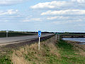 Highway 316 road sign located at the Highway 16 turn off.
 -
 Nutrien Patience Lake Mine north of Highway 16.


See also
References
External links
- Saskatchewan Highways Website-- Highway Numbering
- Saskatchewan Road Map RV Itineraries
- Big Things of Canada, A Celebration of Community Monuments of Canada
- v
- t
- e
- 600
- 601
- 602
- 603
- 604
- 605
- 606
- 607
- 608
- 609
- 610
- 611
- 612
- 613
- 614
- 615
- 616
- 617
- 618
- 619
- 620
- 621
- 622
- 623
- 624
- 626
- 627
- 628
- 629
- 630
- 631
- 632
- 633
- 634
- 635
- 636
- 637
- 638
- 639
- 640
- 641
- 642
- 643
- 644
- 645
- 646
- 647
- 648
- 649
- 650
- 651
- 653
- 654
- 655
- 656
- 657
- 658
- 659
- 660
- 661
- 662
- 663
- 665
- 665
- 667
- 668
- 669
- 670
- 671
- 672
- 673
- 674
- 675
- 676
- 677
- 678
- 679
- 680
- 681
- 682
- 683
- 684
- 685
- 686
- 687
- 688
- 689
- 690
- 691
- 692
- 693
- 694
- 695
- 696
- 697
- 698
- 699
- 700
- 701
- 702
- 703
- 704
- 705
- 706
- 707
- 708
- 709
- 711
- 713
- 714
- 715
- 716
- 717
- 718
- 719
- 720
- 721
- 722
- 724
- 725
- 726
- 727
- 728
- 729
- 730
- 731
- 732
- 733
- 734
- 735
- 737
- 738
- 740
- 741
- 742
- 743
- 744
- 745
- 747
- 748
- 749
- 751
- 752
- 753
- 754
- 755
- 756
- 758
- 759
- 760
- 761
- 762
- 763
- 764
- 766
- 767
- 768
- 769
- 771
- 772
- 773
- 774
- 776
- 777
- 778
- 779
- 780
- 781
- 782
- 783
- 784
- 785
- 786
- 787
- 788
- 789
- 790
- 791
- 792
- 793
- 794
- 795
- 796
- 797
- 798
- 799
 | This Saskatchewan road, road transport or highway-related article is a stub. You can help Wikipedia by expanding it. |
- v
- t
- e


