Salgótarján District
Districts of Hungary in Nógrád
Salgótarján District Salgótarjáni járás | |
|---|---|
Districts of Hungary | |
 Flag  Coat of arms | |
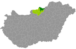 Salgótarján District within Hungary and Nógrád County. | |
| Country |  Hungary Hungary |
| County | Nógrád |
| District seat | Salgótarján |
| Area | |
| • Total | 525.23 km2 (202.79 sq mi) |
| • Rank | 3rd in Nógrád |
| Population (2011 census) | |
| • Total | 64,601 |
| • Rank | 1st in Nógrád |
| • Density | 123/km2 (320/sq mi) |
Salgótarján (Hungarian: Salgótarjáni járás) is a district in north-eastern part of Nógrád County. Salgótarján is also the name of the town where the district seat is found. The district is located in the Northern Hungary Statistical Region.
Geography
Salgótarján District borders with the Slovakian region of Banská Bystrica to the north, Ózd District (Borsod-Abaúj-Zemplén County) and Bátonyterenye District to the southeast, Pásztó District to the south, Szécsény District to the west. The number of the inhabited places in Salgótarján District is 29.
Municipalities
The district has 1 urban county and 28 villages. (ordered by population, as of 1 January 2013)[1]
- Bárna (1,081)
- Cered (1,122)
- Egyházasgerge (741)
- Etes (1,429)
- Ipolytarnóc (452)
- Karancsalja (1,557)
- Karancsberény (884)
- Karancskeszi (1,905)
- Karancslapujtő (2,651)
- Karancsság (1,242)
- Kazár (1,870)
- Kisbárkány (194)
- Kishartyán (536)
- Litke (885)
- Lucfalva (631)
- Márkháza (252)
- Mátraszele (984)
- Mihálygerge (595)
- Nagybárkány (673)
- Nagykeresztúr (247)
- Rákóczibánya (677)
- Ságújfalu (1,059)
- Salgótarján (37,199) – district and county seat
- Sámsonháza (270)
- Somoskőújfalu (2,280)
- Sóshartyán (955)
- Szilaspogony (296)
- Vizslás (1,347)
- Zabar (490)
The bolded municipality is the city.
Demographics
Religion in Salgótarján District (2011 census)
Catholic Church (47.7%)
Greek Catholicism (0.2%)
Lutheranism (1.8%)
Calvinism (1.8%)
Other religions (2.3%)
Non-religious (19.6%)
Atheists (1.2%)
Undeclared (25.4%)
In 2011, it had a population of 64,601 and the population density was 123/km2.
| Year | County population[2] | Change |
|---|---|---|
| 2011 | 64,601 | n/a |
Ethnicity
Besides the Hungarian majority, the main minorities are the Roma (approx. 5,500), Slovak (400) and German (200).
Total population (2011 census): 64,601
Ethnic groups (2011 census):[3] Identified themselves: 62,958 persons:
- Hungarians: 56,484 (89.72%)
- Gypsies: 5,383 (8.55%)
- Others and indefinable: 1,091 (1.73%)
Approx. 1,500 persons in Salgótarján District did not declare their ethnic group at the 2011 census.
Religion
Religious adherence in the county according to 2011 census:[4]
- Catholic – 30,966 (Roman Catholic – 30,846; Greek Catholic – 118);
- Evangelical – 1,182;
- Reformed – 1,136;
- other religions – 1,468;
- Non-religious – 12,682;
- Atheism – 750;
- Undeclared – 16,417.
Gallery
-
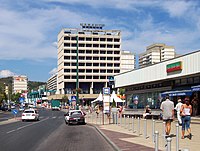 Downtown of Salgótarján
 -
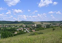 Aerial view of Kazár
 -
 Nature Reserve Ipolytarnóc Fossils
 -

-
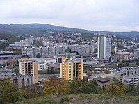 View of Salgótarján
 -
 Town Hall in Salgótarján
 -
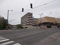
 Conferential Centre (Salgótarján)
 -
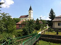 All Saints Church in Karancsberény


See also
References
External links
- Postal codes of the Salgótarján District

48°07′00″N 19°48′00″E / 48.1167°N 19.8000°E / 48.1167; 19.8000
 | This Nógrád county location article is a stub. You can help Wikipedia by expanding it. |
- v
- t
- e


