Ravine
Small valley, often due to stream erosion
A ravine is a landform that is narrower than a canyon and is often the product of streambank erosion.[1] Ravines are typically classified as larger in scale than gullies, although smaller than valleys.[1] Ravines may also be called a cleuch, dell, ghout (Nevis), gill or ghyll, glen, gorge, kloof (South Africa), and chine (Isle of Wight)
A ravine is generally a fluvial slope landform of relatively steep (cross-sectional) sides, on the order of twenty to seventy percent in gradient. Ravines may or may not have active streams flowing along the downslope channel which originally formed them; moreover, often they are characterized by intermittent streams, since their geographic scale may not be sufficiently large to support a perennial stream.[2]
Notable ravines
- Babi Yar, Ukraine
- Bam Bam Amphitheaters, Gabon
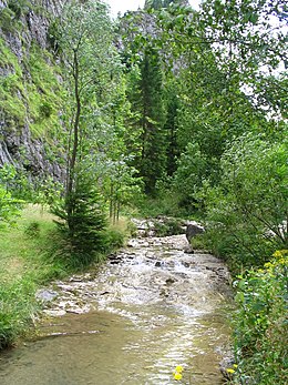
- Barranco de Badajoz, Spain
- Barranco del Infierno, Spain
- Gravina Ravine, Italy
- Moola Chotok, Pakistan
- Ravenna Park, United States
- Rauðfeldsgjá, Iceland
- Stuðlagil, Iceland
- Taishaku Valley, Japan
- Toronto ravine system, Canada
References
- ^ a b Definition of "ravine" at Merriam-Webster
- ^ Christopher G. Morris; Academic Press (1992). Academic Press Dictionary of Science and Technology. Gulf Professional Publishing. pp. 1802–. ISBN 978-0-12-200400-1. Retrieved 1 October 2012.
External links
 Media related to Ravines at Wikimedia Commons
 The dictionary definition of ravine at Wiktionary
- v
- t
- e
(lists)
- Arroyo
- Bourne
- Burn
- Chalk stream
- Coulee
- Current
- Stream bed
- Stream channel
- Streamflow
- Stream gradient
- Stream pool
- Perennial stream
- Winterbourne
(list)
and erosion
- Ait
- Alluvial fan
- Antecedent drainage stream
- Avulsion
- Bank
- Bar
- Bayou
- Billabong
- Canyon
- Chine
- Cut bank
- Estuary
- Floating island
- Fluvial terrace
- Gill
- Gulch
- Gully
- Glen
- Meander scar
- Mouth bar
- Oxbow lake
- Riffle-pool sequence
- Point bar
- Ravine
- Rill
- River island
- Rock-cut basin
- Sedimentary basin
- Sedimentary structures
- Strath
- Thalweg
- River valley
- Wadi
and modelling
- Baer's law
- Baseflow
- Bradshaw model
- Discharge (hydrology)
- Drainage density
- Exner equation
- Groundwater model
- Hack's law
- Hjulström curve
- Hydrograph
- Hydrological model
- Hydrological transport model
- Infiltration (hydrology)
- Main stem
- Playfair's law
- Relief ratio
- River Continuum Concept
- Rouse number
- Runoff curve number
- Runoff model (reservoir)
- Stream gauge
- Universal Soil Loss Equation
- WAFLEX
- Wetted perimeter
- Volumetric flow rate
| Authority control databases: National |
|
|---|
 | This article related to topography is a stub. You can help Wikipedia by expanding it. |
- v
- t
- e
 | This erosion article is a stub. You can help Wikipedia by expanding it. |
- v
- t
- e


