Phú Vang district
You can help expand this article with text translated from the corresponding article in Vietnamese. (March 2009) Click [show] for important translation instructions.
- View a machine-translated version of the Vietnamese article.
- Machine translation, like DeepL or Google Translate, is a useful starting point for translations, but translators must revise errors as necessary and confirm that the translation is accurate, rather than simply copy-pasting machine-translated text into the English Wikipedia.
- Do not translate text that appears unreliable or low-quality. If possible, verify the text with references provided in the foreign-language article.
- You must provide copyright attribution in the edit summary accompanying your translation by providing an interlanguage link to the source of your translation. A model attribution edit summary is
Content in this edit is translated from the existing Vietnamese Wikipedia article at [[:vi:Phú Vang]]; see its history for attribution. - You may also add the template
{{Translated|vi|Phú Vang}}to the talk page. - For more guidance, see Wikipedia:Translation.
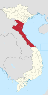
District in North Central Coast, Vietnam
Phú Vang district Huyện Phú Vang | |
|---|---|
 View of Cau Hai lagoon | |
| Country |  Vietnam Vietnam |
| Region | North Central Coast |
| Province | Thừa Thiên Huế |
| Capital | Phú Đa |
| Area | |
| • Total | 90.85 sq mi (235.31 km2) |
| Population (2020) | |
| • Total | 137,962 |
| Time zone | UTC+7 (UTC + 7) |
Phú Vang is a rural district of Thừa Thiên Huế province in the North Central Coast region of Vietnam. As of 2020 the district had a population of 137,962.[1] The district covers an area of 235.31 km². The district capital lies at Phú Đa.
Geography

Phú Vang is located in Thừa Thiên Huế province, North Central Coast of Vietnam. It covers a total area of 235.31 square kilometres (90.85 sq mi). Phú Vang borders the district of Hương Thủy on the west, Phú Lộc district on the south, Huế to the north and the Western Philippine Sea on the east.[2] Phú Vang has 35 kilometres (22 mi) long coastline and the area of the water surface is 6,000 hectares (15,000 acres). Phú Vang is home to many lagoons such as Tam Giang–Cau Hai lagoon.[3]
Phú Vang belongs to the low-lying land with a large size of lagoons. Phú Vang is divided by two area which are rivers and sand dunes. Phú Vang is used for agricultural and aquaculture. Phú Vang has 42.3% of the total natural land area. Phú Vang is known to be home to titanium minerals. Thuận An is located in Phú Vang, it is one of the most important stragetics location.[4]
Administrative divisions
The district contains the township of Phú Đa and 13 communes:
- Phú Xuân
- Phú Mỹ
- Phú An
- Phú Hồ
- Phú Hải
- Phú Thuận
- Phú Diên
- Phú Lương
- Vinh Xuân
- Vinh Thanh
- Vinh An
- Phú Gia
- Vinh Hà
References
- ^ Expansion of Huế city
- ^ "General Information". Thua Thien Hue Portal - Beta. Retrieved 2023-06-16.
- ^ Ngọc, Nguyễn Thị Như (2020-04-22). "Phu Vang district: the potential coastal delta". thuathienhue.gov.vn/en-us. Retrieved 2023-06-16.
- ^ "Lịch sử phát triển, Điều kiện tự nhiên huyện Phú Vang". phuvang.thuathienhue.gov.vn. Retrieved 2023-06-16.
16°25′01″N 107°45′00″E / 16.417°N 107.750°E / 16.417; 107.750
- v
- t
- e
- Đồng Hới city※
- Ba Đồn town
- Bố Trạch
- Lệ Thủy
- Minh Hóa
- Quảng Ninh
- Quảng Trạch
- Tuyên Hóa
- Huế city※
- Hương Thủy town
- Hương Trà town
- A Lưới
- Nam Đông
- Phong Điền
- Phú Lộc
- Phú Vang
- Quảng Điền
※ denotes provincial seat.
 | This article about a location in Thừa Thiên-Huế Province, Vietnam is a stub. You can help Wikipedia by expanding it. |
- v
- t
- e


