Pári
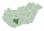
Place in Tolna, Hungary
46°34′47″N 18°15′28″E / 46.57972°N 18.25778°E / 46.57972; 18.25778 Hungary
 (2010)
7091
Pári is a village in Tolna county, Hungary. It is independent again from 2006 (previously it belonged to the municipality of Tamási).[citation needed]
The former railway section of line 49 between Pári and Tamási were converted into a bicycle trail in 2010.
External links
- Pári on Google Maps
- Website of the municipality of Pári (in Hungarian)
- v
- t
- e
Tolna County
- Szekszárd (county seat)

- Alsónána
- Alsónyék
- Aparhant
- Attala
- Báta
- Bátaapáti
- Belecska
- Bikács
- Bogyiszló
- Bonyhádvarasd
- Bölcske
- Cikó
- Csibrák
- Csikóstőttős
- Dalmand
- Diósberény
- Döbrököz
- Dunaszentgyörgy
- Dúzs
- Értény
- Fácánkert
- Felsőnána
- Felsőnyék
- Fürged
- Gerjen
- Grábóc
- Györe
- Györköny
- Gyulaj
- Harc
- Iregszemcse
- Izmény
- Jágónak
- Kajdacs
- Kakasd
- Kalaznó
- Kapospula
- Kaposszekcső
- Keszőhidegkút
- Kéty
- Kisdorog
- Kismányok
- Kisszékely
- Kistormás
- Kisvejke
- Kocsola
- Koppányszántó
- Kölesd
- Kurd
- Lápafő
- Lengyel
- Madocsa
- Magyarkeszi
- Medina
- Miszla
- Mórágy
- Mőcsény
- Mucsfa
- Mucsi
- Murga
- Nagykónyi
- Nagyszékely
- Nagyszokoly
- Nagyvejke
- Nak
- Németkér
- Ozora
- Őcsény
- Pálfa
- Pörböly
- Pusztahencse
- Regöly
- Sárpilis
- Sárszentlőrinc
- Sióagárd
- Szakadát
- Szakály
- Szakcs
- Szálka
- Szárazd
- Szedres
- Tengelic
- Tevel
- Tolnanémedi
- Udvari
- Újireg
- Varsád
- Váralja
- Várdomb
- Várong
- Závod
- Zomba
- History
- Geography
- Government
- Economy
- Culture
- Tourism
 | This Tolna location article is a stub. You can help Wikipedia by expanding it. |
- v
- t
- e


