Municipal District of Smoky River No. 130
Municipal district in Alberta, Canada
Municipal district in Alberta, Canada


Falher
McLennan

Girouxville
Donnelly

Guy
Jean Cote
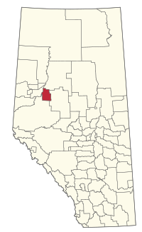
Location within Alberta
(2021)[2]
(2021)[2]
The Municipal District of Smoky River No. 130 is a municipal district (MD) in northwestern Alberta, Canada. Located in Census Division No. 19, its municipal office is located in the Town of Falher.
History
On January 1, 1952, its name was changed from MD of Fillion No. 130 to its current name, which was taken from Smoky River, a tributary of Peace River.
Geography
Communities and localities
| The following urban municipalities are surrounded by the MD of Smoky River No. 130.[3]
The following hamlets are located within the MD of Smoky River No. 130.[3] | The following localities are located within the MD of Smoky River No. 130.[4]
|
Demographics
In the 2021 Census of Population conducted by Statistics Canada, the MD of Smoky River No. 130 had a population of 1,684 living in 637 of its 753 total private dwellings, a change of -16.1% from its 2016 population of 2,006. With a land area of 2,834.18 km2 (1,094.28 sq mi), it had a population density of 0.6/km2 (1.5/sq mi) in 2021.[2]
In the 2016 Census of Population conducted by Statistics Canada, the MD of Smoky River No. 130 had a population of 2,023 living in 720 of its 891 total private dwellings, a -4.8% change from its 2011 population of 2,126. With a land area of 2,840.14 km2 (1,096.58 sq mi), it had a population density of 0.7/km2 (1.8/sq mi) in 2016.[12]
See also
- List of communities in Alberta
- List of francophone communities in Alberta
- List of municipal districts in Alberta
References
- ^ Alberta Municipal Affairs: Municipal Officials Search
- ^ a b c "Population and dwelling counts: Canada, provinces and territories, and census subdivisions (municipalities)". Statistics Canada. February 9, 2022. Retrieved February 9, 2022.
- ^ a b "Specialized and Rural Municipalities and Their Communities" (PDF). Alberta Municipal Affairs. January 12, 2022. Retrieved January 21, 2022.
- ^ "Standard Geographical Classification (SGC) 2006, Economic Regions: 4819041 - Smoky River No. 130, geographical codes and localities, 2006". Statistics Canada. March 5, 2010. Retrieved August 12, 2012.
- ^ "Table 6: Population by sex, for census subdivisions, 1956 and 1951". Census of Canada, 1956. Vol. I: Population. Ottawa: Dominion Bureau of Statistics. 1958.
- ^ "Table 9: Population by census subdivisions, 1966 by sex, and 1961". 1966 Census of Canada. Western Provinces. Vol. Population: Divisions and Subdivisions. Ottawa: Dominion Bureau of Statistics. 1967.
- ^ "Table 3: Population for census divisions and subdivisions, 1971 and 1976". 1976 Census of Canada. Census Divisions and Subdivisions, Western Provinces and the Territories. Vol. Population: Geographic Distributions. Ottawa: Statistics Canada. 1977.
- ^ "Table 2: Census Subdivisions in Alphabetical Order, Showing Population Rank, Canada, 1981". 1981 Census of Canada. Vol. Census subdivisions in decreasing population order. Ottawa: Statistics Canada. 1982. ISBN 0-660-51563-6.
- ^ "Table 2: Population and Dwelling Counts, for Census Divisions and Census Subdivisions, 1986 and 1991 – 100% Data". 91 Census. Vol. Population and Dwelling Counts – Census Divisions and Census Subdivisions. Ottawa: Statistics Canada. 1992. pp. 100–108. ISBN 0-660-57115-3.
- ^ "Population and Dwelling Counts, for Canada, Provinces and Territories, and Census Divisions, 2001 and 1996 Censuses – 100% Data (Alberta)". Statistics Canada. Retrieved May 25, 2019.
- ^ "Population and dwelling counts, for Canada, provinces and territories, and census subdivisions (municipalities), 2006 and 2001 censuses – 100% data (Alberta)". Statistics Canada. January 6, 2010. Retrieved May 25, 2019.
- ^ a b "Population and dwelling counts, for Canada, provinces and territories, and census subdivisions (municipalities), 2016 and 2011 censuses – 100% data (Alberta)". Statistics Canada. February 8, 2017. Retrieved February 8, 2017.
External links
- Official website

Places adjacent to Municipal District of Smoky River No. 130 | |
|---|---|


- v
- t
- e
Subdivisions of Alberta
service areas
municipalities
municipalities
- Crowsnest Pass, Municipality of
- Jasper, Municipality of
- Lac La Biche County
- Mackenzie County
- Strathcona County
- Wood Buffalo, Regional Municipality of
 Category
 Canada portal
 WikiProject


| Authority control databases |
|
|---|


