Millerville, Alabama
Census-designated place in Alabama, United States
33°11′29″N 85°55′33″W / 33.19139°N 85.92583°W / 33.19139; -85.92583 (2020)
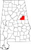
Millerville is a census-designated place and unincorporated community in Clay County, Alabama, United States. Its population was 303 as of the 2020 census.
Demographics
| Census | Pop. | Note | %± |
|---|---|---|---|
| 2020 | 303 | — | |
| U.S. Decennial Census[3] | |||
References
- ^ "2020 U.S. Gazetteer Files". United States Census Bureau. Retrieved October 29, 2021.
- ^ "Millerville". Geographic Names Information System. United States Geological Survey, United States Department of the Interior.
- ^ "Census of Population and Housing". Census.gov. Retrieved June 4, 2016.
- v
- t
- e
Municipalities and communities of Clay County, Alabama, United States
County seat: Ashland
communities
- Alabama portal
- United States portal
 | This Clay County, Alabama state location article is a stub. You can help Wikipedia by expanding it. |
- v
- t
- e


