Merrifield, Minnesota
Unincorporated community in Minnesota, US
Census-designated place and Unincorporated community in Minnesota, United States
46°27′54″N 94°10′22″W / 46.46500°N 94.17278°W / 46.46500; -94.17278 (2020)
56465
Merrifield is an unincorporated community and census-designated place (CDP) in Lake Edward Township, Crow Wing County, Minnesota, United States, near Brainerd. It is along Crow Wing County Road 3 near County Road 127. Its population was 140 as of the 2010 census.[3]
Demographics
| Census | Pop. | Note | %± |
|---|---|---|---|
| 2020 | 140 | — | |
| U.S. Decennial Census[4] | |||
History
A post office called Merrifield has been in operation since 1899.[5] The community was named for the original owner of the town site.[6]
Education
It is in Brainerd Public Schools.[7] The zoned high school is Brainerd High School.
References
- ^ "2020 U.S. Gazetteer Files". United States Census Bureau. Retrieved July 24, 2022.
- ^ a b U.S. Geological Survey Geographic Names Information System: Merrifield, Minnesota
- ^ "U.S. Census website". United States Census Bureau. Retrieved May 14, 2011.
- ^ "Census of Population and Housing". Census.gov. Retrieved June 4, 2016.
- ^ "Crow Wing County". Jim Forte Postal History. Retrieved May 10, 2015.
- ^ Warren Upham (1920). Minnesota Geographic Names: Their Origin and Historic Significance. Minnesota Historical Society. p. 158.
- ^ "2020 CENSUS - SCHOOL DISTRICT REFERENCE MAP: Crow Wing County, MN" (PDF). U.S. Census Bureau. Retrieved July 7, 2021.
- v
- t
- e
Municipalities and communities of Crow Wing County, Minnesota, United States
County seat: Brainerd

territories
- Merrifield
communities
reservation
‡This populated place also has portions in an adjacent county or counties
- Minnesota portal
- United States portal
Cities in the Brainerd Lakes area, Minnesota | |||||
|---|---|---|---|---|---|
| Core city | 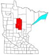 | ||||
| Surrounding communities |
| ||||
| Counties | |||||
† indicates a county seat. ‡ indicates that it is partially in the micropolitan area. § indicates a CDP. | |||||
This article about a location in Crow Wing County, Minnesota is a stub. You can help Wikipedia by expanding it. |
- v
- t
- e


