List of historic places in the Bonavista Bay region


Bonavista Peninsula
class=notpageimage|
Location of Bonavista Peninsula in Newfoundland; Bonavista Bay is to its northwest, Trinity Bay to its southeast.This article is a list of historic places in the Bonavista Bay region of the Canadian province of Newfoundland and Labrador. These properties are entered on the Canadian Register of Historic Places, whether they are federal, provincial, or municipal. The list contains entries found in communities on the Bonavista Peninsula, from Clarenville north and east.
Map all coordinates using OpenStreetMap
Download coordinates as:
- KML
- GPX (all coordinates)
- GPX (primary coordinates)
- GPX (secondary coordinates)
List of historic places
| Name | Address | Coordinates | Government recognition (CRHP №) | Image | |
|---|---|---|---|---|---|
| Heber John Abbott House | Bonavista NL | 48°39′57″N 53°06′10″W / 48.6657°N 53.1027°W / 48.6657; -53.1027 (Heber John Abbott House) | Newfoundland and Labrador (1883), Bonavista municipality (5944) | 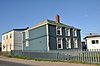 More images | |
| Samuel Abbott House and Fishing Premises Registered Heritage Structure | Bonavista NL | 48°39′12″N 53°06′14″W / 48.6532°N 53.1038°W / 48.6532; -53.1038 (Samuel Abbott House and Fishing Premises Registered Heritage Structure) | Newfoundland and Labrador (1938), Bonavista municipality (5933) | 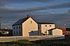 More images | |
| Alexander Chapel of All Souls Mortuary Chapel | Bonavista NL | 48°39′17″N 53°06′09″W / 48.6547°N 53.1026°W / 48.6547; -53.1026 (Alexander Chapel of All Souls Mortuary Chapel) | Newfoundland and Labrador (2191), Bonavista municipality (5868) | 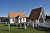 More images | |
| William Alexander House (Bridge House) Registered Heritage Structure | Bonavista NL | 48°39′08″N 53°06′43″W / 48.6521°N 53.112°W / 48.6521; -53.112 (William Alexander House (Bridge House) Registered Heritage Structure) | Newfoundland and Labrador (1846), Bonavista municipality (5873) | 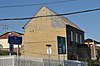 More images | |
| All Saints Anglican Church Registered Heritage Structure | English Harbour NL | 48°22′20″N 53°15′50″W / 48.3722°N 53.264°W / 48.3722; -53.264 (All Saints Anglican Church Registered Heritage Structure) | Newfoundland and Labrador (3760) |  Upload Photo | |
| Bailey's Cove Church of England School | Bonavista NL | 48°39′39″N 53°06′46″W / 48.6607°N 53.1127°W / 48.6607; -53.1127 (Bailey's Cove Church of England School) | Newfoundland and Labrador (1847), Bonavista municipality (5940) |  More images | |
| Band of Hope Loyal Orange Lodge LOL 1402 Municipal Heritage Building | Elliston NL | 48°38′01″N 53°02′38″W / 48.6335°N 53.0439°W / 48.6335; -53.0439 (Band of Hope Loyal Orange Lodge LOL 1402 Municipal Heritage Building) | Elliston municipality (8002) |  More images | |
| Archibald Bennett House | Brooklyn NL | 48°22′57″N 53°52′04″W / 48.3826°N 53.8679°W / 48.3826; -53.8679 (Archibald Bennett House) | Newfoundland and Labrador (2178) | Upload Photo | |
| Campbell House | Trinity NL | 48°22′04″N 53°21′38″W / 48.3678°N 53.3606°W / 48.3678; -53.3606 (Campbell House) | Trinity municipality (2075) |  | |
| Cape Bonavista Lighthouse | Bonavista NL | 48°42′06″N 53°05′07″W / 48.7016°N 53.0854°W / 48.7016; -53.0854 (Cape Bonavista Lighthouse) | Newfoundland and Labrador (3060) |  More images | |
| Christ Church Churchyard Cemetery Municipal Heritage Site | Bonavista NL | 48°34′04″N 53°20′04″W / 48.5677°N 53.3344°W / 48.5677; -53.3344 (Christ Church Churchyard Cemetery Municipal Heritage Site) | Bonavista municipality (5869) |  More images | |
| Archibald Christian House Registered Heritage Structure | 20 Church Road Trinity NL | 48°34′04″N 53°20′04″W / 48.5677°N 53.3344°W / 48.5677; -53.3344 (Archibald Christian House Registered Heritage Structure) | Newfoundland and Labrador (19044) | Upload Photo | |
| Church of the Most Holy Trinity | Trinity NL | 48°22′04″N 53°21′30″W / 48.3679°N 53.3584°W / 48.3679; -53.3584 (Church of the Most Holy Trinity) | Newfoundland and Labrador (3756) |  More images | |
| Clarenville Railway Station Municipal Heritage Building | Clarenville NL | 48°10′21″N 53°57′48″W / 48.1725°N 53.9632°W / 48.1725; -53.9632 (Clarenville Railway Station Municipal Heritage Building) | Clarenville municipality (7280) | 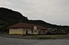 More images | |
| Coleman / Jenkins Commercial Establishment | Trinity NL | 48°22′02″N 53°21′25″W / 48.3673°N 53.357°W / 48.3673; -53.357 (Coleman / Jenkins Commercial Establishment) | Newfoundland and Labrador (2311) |  More images | |
| The Currie Premises | Britannia NL | 48°08′46″N 53°43′15″W / 48.1461°N 53.7207°W / 48.1461; -53.7207 (The Currie Premises) | Newfoundland and Labrador (2061) | Upload Photo | |
| William Ellis Saint House | Bonavista NL | 48°38′45″N 53°06′54″W / 48.6458°N 53.115°W / 48.6458; -53.115 (William Ellis Saint House) | Newfoundland and Labrador (2339), Bonavista municipality (5943) |  More images | |
| Elliston United Church Municipal Heritage Building | Elliston NL | 48°38′00″N 53°02′29″W / 48.6333°N 53.0415°W / 48.6333; -53.0415 (Elliston United Church Municipal Heritage Building) | Elliston municipality (7476) |  More images | |
| Evelley House | Trinity East NL | 48°22′48″N 53°20′51″W / 48.3799°N 53.3476°W / 48.3799; -53.3476 (Evelley House) | Newfoundland and Labrador (2626) |  More images | |
| Factory/Advocate Building | Port Union NL | 48°29′55″N 53°04′52″W / 48.4987°N 53.0811°W / 48.4987; -53.0811 (Factory/Advocate Building) | Newfoundland and Labrador (2148), Port Union municipality (5977) |  More images | |
| Fishermen's Union Trading Company Retail Store Registered Heritage Structure | Port Union NL | 48°29′57″N 53°04′54″W / 48.4991°N 53.0816°W / 48.4991; -53.0816 (Fishermen's Union Trading Company Retail Store Registered Heritage Structure) | Newfoundland and Labrador (7782) |  More images | |
| Fishermen's Union Trading Company Salt Fish Plant Registered Heritage Structure | Port Union NL | 48°29′57″N 53°04′55″W / 48.4993°N 53.0819°W / 48.4993; -53.0819 (Fishermen's Union Trading Company Salt Fish Plant Registered Heritage Structure) | Newfoundland and Labrador (7781) |  More images | |
| Dan Goodland Downstairs Root Cellar Municipal Heritage Structure | Elliston NL | 48°37′58″N 53°02′01″W / 48.6327°N 53.0337°W / 48.6327; -53.0337 (Dan Goodland Downstairs Root Cellar Municipal Heritage Structure) | Elliston municipality (7472) |  More images | |
| Jim Goodland Upstairs Root Cellar Municipal Heritage Structure | Elliston NL | 48°37′24″N 53°01′03″W / 48.6232°N 53.0174°W / 48.6232; -53.0174 (Jim Goodland Upstairs Root Cellar Municipal Heritage Structure) | Elliston municipality (7473) |  More images | |
| Gover House | Trinity NL | 48°22′04″N 53°21′38″W / 48.3678°N 53.3606°W / 48.3678; -53.3606 (Gover House) | Newfoundland and Labrador (2298) |  More images | |
| Government of Canada Building | 24-28 Church Street Trinity NL | 48°39′13″N 53°06′42″W / 48.6537°N 53.1118°W / 48.6537; -53.1118 (Government of Canada Building) | Federal (9478) | Upload Photo | |
| Grant's Stage | Trinity NL | 48°22′02″N 53°21′25″W / 48.3673°N 53.357°W / 48.3673; -53.357 (Grant's Stage) | Newfoundland and Labrador (2313) |  More images | |
| Green Family Forge | Trinity NL | 48°22′14″N 53°21′36″W / 48.3706°N 53.36°W / 48.3706; -53.36 (Green Family Forge) | Newfoundland and Labrador (2116) |  More images | |
| Green Island Lighthouse | Green Island, off the coast of Catalina Catalina NL | 48°30′15″N 53°02′35″W / 48.5042°N 53.0431°W / 48.5042; -53.0431 (Green Island Lighthouse) | Federal (21133, (4760), Newfoundland and Labrador (4761) | Upload Photo | |
| James Groves House | Bonavista NL | 48°39′24″N 53°06′55″W / 48.6567°N 53.1152°W / 48.6567; -53.1152 (James Groves House) | Newfoundland and Labrador (1885), Bonavista municipality (5945) | 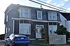 More images | |
| John Hancock House | Portland NL | 48°25′00″N 53°49′00″W / 48.4167°N 53.8167°W / 48.4167; -53.8167 (John Hancock House) | Newfoundland and Labrador (2303) | Upload Photo | |
| James Leo Harty House and Outbuildings | Duntara NL | 48°36′08″N 53°22′12″W / 48.6021°N 53.3701°W / 48.6021; -53.3701 (James Leo Harty House and Outbuildings) | Newfoundland and Labrador (2023) | Upload Photo | |
| Hiscock House (Mountain Ash Villa) | Trinity NL | 48°22′14″N 53°21′31″W / 48.3706°N 53.3585°W / 48.3706; -53.3585 (Hiscock House (Mountain Ash Villa)) | Newfoundland and Labrador (3757) |  More images | |
| Jubilee House | Bonavista NL | 48°39′10″N 53°06′41″W / 48.6529°N 53.1113°W / 48.6529; -53.1113 (Jubilee House) | Newfoundland and Labrador (2138), Bonavista municipality (5947) | 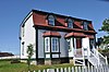 More images | |
| Lawlor House | Trinity East NL | 48°22′46″N 53°20′46″W / 48.3794°N 53.346°W / 48.3794; -53.346 (Lawlor House) | Newfoundland and Labrador (2297) | Upload Photo | |
| Lawrence Cottage | Bonavista NL | 48°39′10″N 53°06′41″W / 48.6529°N 53.1113°W / 48.6529; -53.1113 (Lawrence Cottage) | Newfoundland and Labrador (3595), Bonavista municipality (5939) |  More images | |
| Lester-Garland Premises | Trinity NL | 48°22′20″N 53°21′36″W / 48.3722°N 53.3599°W / 48.3722; -53.3599 (Lester-Garland Premises) | Newfoundland and Labrador (3753) |  More images | |
| Lighttower | King's Cove NL | 48°34′37″N 53°19′17″W / 48.5770°N 53.3213°W / 48.5770; -53.3213 (Lighttower (King's Cove Head Light)) | Federal (3976) | Upload Photo | |
| Lighttower | Random Island NL | 48°05′41″N 53°32′43″W / 48.0947°N 53.5453°W / 48.0947; -53.5453 (Lighttower (Random Head Light)) | Federal (3993) | Upload Photo | |
| Lockyer/Swyers House | Bonavista NL | 48°39′08″N 53°06′39″W / 48.6522°N 53.1107°W / 48.6522; -53.1107 (Lockyer/Swyers House) | Newfoundland and Labrador (1869), Bonavista municipality (5946) | 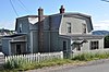 More images | |
| Loyal Orange Lodge LOL #4 | Bonavista NL | 48°39′08″N 53°06′55″W / 48.6521°N 53.1154°W / 48.6521; -53.1154 (Loyal Orange Lodge LOL #4) | Newfoundland and Labrador (1882), Bonavista municipality (5941) |  More images | |
| Methodist Schoolhouse / SUF Hall | Trinity NL | 48°22′02″N 53°21′31″W / 48.3671°N 53.3587°W / 48.3671; -53.3587 (Methodist Schoolhouse / SUF Hall) | Newfoundland and Labrador (3658) | Upload Photo | |
| Edwin and Priscilla Miller House | New Bonaventure NL | 48°17′18″N 53°27′00″W / 48.2883°N 53.45°W / 48.2883; -53.45 (Edwin and Priscilla Miller House) | Newfoundland and Labrador (2093) | Upload Photo | |
| Mockbeggar Plantation | Bonavista NL | 48°39′22″N 53°06′51″W / 48.6562°N 53.1143°W / 48.6562; -53.1143 (Mockbeggar Plantation) | Newfoundland and Labrador (4126) | 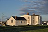 More images | |
| Mockbeggar Plantation Fish Store | Bonavista NL | 48°39′22″N 53°06′51″W / 48.6562°N 53.1143°W / 48.6562; -53.1143 (Mockbeggar Plantation Fish Store) | Newfoundland and Labrador (4053) |  More images | |
| Monks House | King's Cove NL | 48°34′02″N 53°20′11″W / 48.5671°N 53.3365°W / 48.5671; -53.3365 (Monks House) | Newfoundland and Labrador (2231) | Upload Photo | |
| Nathanial Morris House | Trinity NL | 48°22′02″N 53°21′39″W / 48.3673°N 53.3609°W / 48.3673; -53.3609 (Nathanial Morris House) | Newfoundland and Labrador (2299) |  More images | |
| Mortuary Chapel | Trinity NL | 48°22′16″N 53°22′03″W / 48.3712°N 53.3676°W / 48.3712; -53.3676 (Mortuary Chapel) | Newfoundland and Labrador (2319) |  More images | |
| Adam Mouland Property Registered Heritage Structure | Bonavista NL | 48°39′22″N 53°06′21″W / 48.6561°N 53.1057°W / 48.6561; -53.1057 (Adam Mouland Property Registered Heritage Structure) | Newfoundland and Labrador (8238) | Upload Photo | |
| William Pardy Property Registered Heritage Structure | Bonavista NL | 48°38′41″N 53°06′52″W / 48.6446°N 53.1145°W / 48.6446; -53.1145 (William Pardy Property Registered Heritage Structure) | Newfoundland and Labrador (8241) |  More images | |
| The Parish Hall | Trinity NL | 48°22′21″N 53°21′36″W / 48.3724°N 53.36°W / 48.3724; -53.36 (The Parish Hall) | Newfoundland and Labrador (2320) |  More images | |
| George Pearce Root Cellar Municipal Heritage Structure | Elliston NL | 48°39′28″N 52°46′54″W / 48.6578°N 52.7817°W / 48.6578; -52.7817 (George Pearce Root Cellar Municipal Heritage Structure) | Elliston municipality (7474) | Upload Photo | |
| Tom Porter Root Cellar Municipal Heritage Structure | Elliston NL | 48°37′56″N 53°02′12″W / 48.6322°N 53.0366°W / 48.6322; -53.0366 (George Pearce Root Cellar Municipal Heritage Structure) | Elliston municipality (7496) | Upload Photo | |
| Port Union Historic District National Historic Site of Canada | Harbour Front, Reid Road, Coaker Road and the Power Station Port Union NL | 48°30′00″N 53°05′00″W / 48.5°N 53.0833°W / 48.5; -53.0833 (Port Union Historic District National Historic Site of Canada) | Federal (7657), Newfoundland and Labrador (10189), Port Union municipality (5328) |  More images | |
| Port Union Hydro-Electric Generating Station | Port Union NL | 48°29′53″N 53°05′23″W / 48.4981°N 53.0898°W / 48.4981; -53.0898 (Port Union Hydro-Electric Generating Station) | Newfoundland and Labrador (4365) |  More images | |
| William Pye House Registered Heritage Structure | Brooklyn NL | 48°23′06″N 53°52′18″W / 48.3851°N 53.8718°W / 48.3851; -53.8718 (William Pye House Registered Heritage Structure) | Newfoundland and Labrador (10172) | Upload Photo | |
| John Quinton Limited - Fish Store and Salt Store | Red Cliffe NL | 48°34′31″N 53°29′39″W / 48.5752°N 53.4943°W / 48.5752; -53.4943 (John Quinton Limited - Fish Store and Salt Store) | Newfoundland and Labrador (2335) | Upload Photo | |
| John Quinton Limited Post Office Registered Heritage Structure | Red Cliffe NL | 48°34′31″N 53°29′39″W / 48.5752°N 53.4943°W / 48.5752; -53.4943 (John Quinton Limited Post Office Registered Heritage Structure) | Newfoundland and Labrador (2336) | Upload Photo | |
| John Quinton Limited Residence Registered Heritage Structure | Red Cliffe NL | 48°34′31″N 53°29′39″W / 48.5752°N 53.4943°W / 48.5752; -53.4943 (John Quinton Limited Residence Registered Heritage Structure) | Newfoundland and Labrador (2337) | Upload Photo | |
| John Quinton Limited Shop Registered Heritage Structure | Red Cliffe NL | 48°34′31″N 53°29′39″W / 48.5752°N 53.4943°W / 48.5752; -53.4943 (John Quinton Limited Shop Registered Heritage Structure) | Newfoundland and Labrador (2338) | Upload Photo | |
| Ryan Fish Storage | 2 Ryan's Hill Bonavista NL | 48°38′51″N 53°06′45″W / 48.6476°N 53.1124°W / 48.6476; -53.1124 (Ryan Fish Storage) | Federal (9929) | 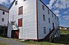 More images | |
| Ryan Premises National Historic Site of Canada | 2 Ryan's Hill Bonavista NL | 48°38′52″N 53°06′47″W / 48.6478°N 53.113°W / 48.6478; -53.113 (Ryan Premises National Historic Site of Canada) | Federal (4428) | 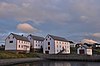 More images | |
| Ryan Residence | 2 Ryan's Hill Bonavista NL | 48°38′52″N 53°06′43″W / 48.6478°N 53.1119°W / 48.6478; -53.1119 (Ryan Residence) | Federal (9931) |  More images | |
| Ryan Retail Store | 2 Ryan's Hill Bonavista NL | 48°38′53″N 53°06′45″W / 48.648°N 53.1124°W / 48.648; -53.1124 (Ryan Retail Store) | Federal (9930) |  More images | |
| James Ryan Shop | Elliston NL | 48°38′02″N 53°02′21″W / 48.6339°N 53.0391°W / 48.6339; -53.0391 (James Ryan Shop) | Newfoundland and Labrador (2301), Elliston municipality (7479) |  More images | |
| Ryan Store and Fish Purchasing Centre | 2 Ryan's Hill Bonavista NL | 48°38′53″N 53°06′45″W / 48.648°N 53.1125°W / 48.648; -53.1125 (Ryan Store and Fish Purchasing Centre) | Federal (9932) | 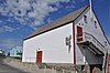 More images | |
| James Ryan Tenement House | Old Catalina Road Bonavista NL | 48°38′51″N 53°06′44″W / 48.6475°N 53.1123°W / 48.6475; -53.1123 (James Ryan Tenement House) | Newfoundland and Labrador (2029), Bonavista municipality (6132) |  More images | |
| St. Andrew's Anglican Church | Brooklyn NL | 48°23′48″N 53°52′12″W / 48.3967°N 53.8699°W / 48.3967; -53.8699 (St. Andrew's Anglican Church) | Newfoundland and Labrador (1850) | 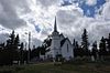 More images | |
| St. Joseph's Roman Catholic Cemetery Municipal Heritage Site | Bonavista NL | 48°38′55″N 53°06′33″W / 48.6487°N 53.1093°W / 48.6487; -53.1093 (St. Joseph's Roman Catholic Cemetery Municipal Heritage Site) | Bonavista municipality (8242) |  More images | |
| St. Joseph's Roman Catholic Church | Bonavista NL | 48°38′57″N 53°06′35″W / 48.6492°N 53.1097°W / 48.6492; -53.1097 (St. Joseph's Roman Catholic Church) | Newfoundland and Labrador (3945), Bonavista municipality (6126) | 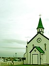 More images | |
| St. Joseph's Roman Catholic Presbytery | Bonavista NL | 48°38′57″N 53°06′35″W / 48.6492°N 53.1097°W / 48.6492; -53.1097 (St. Joseph's Roman Catholic Presbytery) | Newfoundland and Labrador (2139), Bonavista municipality (5936) |  More images | |
| St. Mary's Anglican Church | Elliston NL | 48°37′59″N 53°02′36″W / 48.633°N 53.0433°W / 48.633; -53.0433 (St. Mary's Anglican Church) | Newfoundland and Labrador (1854), Elliston municipality (7477) |  More images | |
| St. Paul's Anglican Church | Trinity NL | 48°22′09″N 53°21′30″W / 48.3691°N 53.3582°W / 48.3691; -53.3582 (St. Paul's Anglican Church) | Newfoundland and Labrador (2330) |  More images | |
| St. Peter's Anglican Church | Catalina NL | 48°31′03″N 53°04′53″W / 48.5174°N 53.0814°W / 48.5174; -53.0814 (St. Peter's Anglican Church) | Newfoundland and Labrador (2106) | 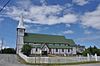 More images | |
| St. Paul's Anglican School | Trinity NL | 48°22′11″N 53°21′35″W / 48.3697°N 53.3598°W / 48.3697; -53.3598 (St. Paul's Anglican School) | Newfoundland and Labrador (4016) | 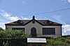 More images | |
| Shoal Harbour Methodist Cemetery Municipal Heritage Site | Clarenville NL | 48°11′22″N 53°58′03″W / 48.1894°N 53.9675°W / 48.1894; -53.9675 (Shoal Harbour Methodist Cemetery Municipal Heritage Site) | Clarenville municipality (14412) | Upload Photo | |
| Slade House | Trinity NL | 48°22′12″N 53°21′48″W / 48.3699°N 53.3634°W / 48.3699; -53.3634 (Slade House) | Newfoundland and Labrador (2077) |  More images | |
| Society of United Fishermen SUF Lodge #9 | Bonavista NL | 48°39′19″N 53°06′41″W / 48.6552°N 53.1113°W / 48.6552; -53.1113 (Society of United Fishermen SUF Lodge #9) | Newfoundland and Labrador (2104), Bonavista municipality (5938) | 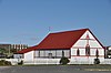 More images | |
| Alexander and Jennie Templeman House | Bonavista NL | 48°39′23″N 53°06′45″W / 48.6564°N 53.1126°W / 48.6564; -53.1126 (Alexander and Jennie Templeman House) | Newfoundland and Labrador (1849), Bonavista municipality (5942) | 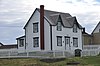 More images | |
| Dugald Templeman House Registered Heritage Structure | Bonavista NL | 48°39′26″N 53°06′48″W / 48.6571°N 53.1133°W / 48.6571; -53.1133 (Dugald Templeman House Registered Heritage Structure) | Newfoundland and Labrador (15661) | 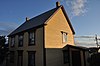 | |
| Joseph and Selena Templeman Property | Bonavista NL | 48°39′29″N 53°06′50″W / 48.6581°N 53.1139°W / 48.6581; -53.1139 (Joseph and Selena Templeman Property) | Newfoundland and Labrador (1867), Bonavista municipality (6125) |  More images | |
| Philip Templeman Building/Swyers General Store Registered Heritage Structure | Bonavista NL | 48°38′56″N 53°06′41″W / 48.6488°N 53.1115°W / 48.6488; -53.1115 (Philip Templeman Building/Swyers General Store Registered Heritage Structure) | Newfoundland and Labrador (1868), Bonavista municipality (5948) | 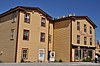 More images | |
| Robert Tilley House | Elliston NL | 48°38′03″N 53°02′21″W / 48.6342°N 53.0391°W / 48.6342; -53.0391 (Robert Tilley House) | Newfoundland and Labrador (3758), Elliston municipality (7478) | 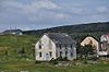 More images | |
| Henry Tremblett House | Bonavista NL | 48°39′34″N 53°06′40″W / 48.6595°N 53.111°W / 48.6595; -53.111 (Henry Tremblett House) | Newfoundland and Labrador (2079), Bonavista municipality (5937) |  More images | |
| Trinity Courthouse, Gaol and General Building | Trinity NL | 48°22′21″N 53°21′36″W / 48.3724°N 53.36°W / 48.3724; -53.36 (Trinity Courthouse, Gaol and General Building) | Newfoundland and Labrador (2115) |  More images | |
| Trinity Harbour Provincial Historic Site | Shipwreck site in Trinity Harbour Trinity NL | 48°21′59″N 53°20′55″W / 48.3665°N 53.3485°W / 48.3665; -53.3485 (Trinity Harbour Provincial Historic Site) | Newfoundland and Labrador (3596) |  More images | |
| Trinity Heritage Area Municipal Heritage District (2007) | Trinity NL | 48°21′56″N 53°21′28″W / 48.3656°N 53.3577°W / 48.3656; -53.3577 (Trinity Heritage Area Municipal Heritage District (2007)) | Trinity municipality (12062) |  | |
| Trinity Historic Area | Trinity NL | 48°21′55″N 53°21′28″W / 48.3654°N 53.3577°W / 48.3654; -53.3577 (Trinity Historic Area) | Trinity municipality (5263) |  | |
| Trinity Train Loop | Trinity NL | 48°23′02″N 53°19′32″W / 48.384°N 53.3255°W / 48.384; -53.3255 (Trinity Train Loop) | Newfoundland and Labrador (2175) |  More images | |
| William (Billy) Wheeler House Registered Heritage Structure | Keels NL | 48°36′19″N 53°24′31″W / 48.6054°N 53.4086°W / 48.6054; -53.4086 (William (Billy) Wheeler House Registered Heritage Structure) | Newfoundland and Labrador (8240) | Upload Photo | |
| Frederick Mifflin House | 21 Church Street | 48°39′12.6″N 53°6′43.2″W / 48.653500°N 53.112000°W / 48.653500; -53.112000 | Invalid (19406) | Q51185470 | Upload Photo |
| John Mifflin House | 17-19 Church Street | 48°39′11.4″N 53°6′43.2″W / 48.653167°N 53.112000°W / 48.653167; -53.112000 | Invalid (19407) | Q51185469 | Upload Photo |
| Samson Mifflin House | 15 Church Street | 48°39′11.2″N 53°6′44.6″W / 48.653111°N 53.112389°W / 48.653111; -53.112389 | Invalid (19405) | Q51324592 | Upload Photo |
| Memorial United Church | Church Road | 48°39′16.7″N 53°6′43.6″W / 48.654639°N 53.112111°W / 48.654639; -53.112111 | Invalid (19410) | Q51324632 |  More images |
| Frederick Harris House | 59 Hospital Road | 48°38′48.6″N 53°6′35.9″W / 48.646833°N 53.109972°W / 48.646833; -53.109972 | Invalid (19041) | Q51409264 | Upload Photo |
| Methodist Central School | Coster Street | 48°39′8.1″N 53°6′37.8″W / 48.652250°N 53.110500°W / 48.652250; -53.110500 | Q51409976 | Upload Photo |
See also
- List of historic places in Newfoundland and Labrador
- List of National Historic Sites of Canada in Newfoundland and Labrador
- v
- t
- e
- Cape Spear Lighthouse
- Castle Hill
- Hawthorne Cottage
- Hopedale Mission
- Kitjigattalik - Ramah Chert Quarries
- L'Anse aux Meadows
- Port au Choix
- Ryan Premises
- Signal Hill
- more...
Ecological Reserves
 Category
- St. John's geography
 Commons


