Lenti District
Districts of Hungary in Zala
Lenti District Lenti járás | |
|---|---|
Districts of Hungary | |
 Coat of arms | |
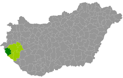 Lenti District within Hungary and Zala County. | |
| Coordinates: 46°37′N 16°32′E / 46.62°N 16.54°E / 46.62; 16.54 | |
| Country |  Hungary Hungary |
| County | Zala |
| District seat | Lenti |
| Area | |
| • Total | 624.12 km2 (240.97 sq mi) |
| • Rank | 3rd in Zala |
| Population (2011 census) | |
| • Total | 19,789 |
| • Rank | 4th in Zala |
| • Density | 32/km2 (80/sq mi) |
Lenti (Hungarian: Lenti járás) is a district in Zala County.[1] Lenti is also the name of the town where the district seat is found. The district is located in the Western Transdanubia Statistical Region.
Geography
Lenti District borders with Körmend District (Vas County) to the north, Zalaegerszeg District to the east, Letenye District to the south, Slovenia to the west. The number of the inhabited places in Lenti District is 48.
Municipalities
The district has 1 town and 47 villages. (ordered by population, as of 1 January 2013)[1]
- Alsószenterzsébet (57)
- Baglad (50)
- Barlahida (120)
- Belsősárd (97)
- Bödeháza (43)
- Csesztreg (860)
- Csömödér (636)
- Dobri (155)
- Felsőszenterzsébet (17)
- Gáborjánháza (71)
- Gosztola (54)
- Hernyék (101)
- Iklódbördőce (281)
- Kálócfa (160)
- Kányavár (122)
- Kerkabarabás (276)
- Kerkafalva (100)
- Kerkakutas (126)
- Kerkateskánd (169)
- Kissziget (189)
- Kozmadombja (51)
- Külsősárd (69)
- Lendvadedes (25)
- Lendvajakabfa (19)
- Lenti (7,961) – district seat
- Lovászi (1,242)
- Magyarföld (29)
- Márokföld (43)
- Mikekarácsonyfa (277)
- Nemesnép (118)
- Nova (821)
- Ortaháza (108)
- Páka (1,156)
- Pórszombat (290)
- Pördefölde (52)
- Pusztaapáti (27)
- Ramocsa (31)
- Resznek (279)
- Rédics (916)
- Szécsisziget (218)
- Szentgyörgyvölgy (427)
- Szijártóháza (28)
- Szilvágy (182)
- Tormafölde (323)
- Tornyiszentmiklós (607)
- Zalabaksa (689)
- Zalaszombatfa (45)
- Zebecke (66)
The bolded municipality is city.
See also
References
- ^ a b "A KSH 2013. évi helységnévkönyve". ksh.hu. Retrieved 2017-10-27.
External links
 Media related to Lenti District at Wikimedia Commons
- Postal codes of the Lenti District
- v
- t
- e
- Lenti (district seat)

- Alsószenterzsébet
- Baglad
- Barlahida
- Belsősárd
- Bödeháza
- Csesztreg
- Csömödér
- Dobri
- Felsőszenterzsébet
- Gáborjánháza
- Gosztola
- Hernyék
- Iklódbördőce
- Kálócfa
- Kányavár
- Kerkabarabás
- Kerkafalva
- Kerkakutas
- Kerkateskánd
- Kissziget
- Kozmadombja
- Külsősárd
- Lendvadedes
- Lendvajakabfa
- Lovászi
- Magyarföld
- Márokföld
- Mikekarácsonyfa
- Nemesnép
- Nova
- Ortaháza
- Páka
- Pórszombat
- Pördefölde
- Pusztaapáti
- Ramocsa
- Resznek
- Rédics
- Szécsisziget
- Szentgyörgyvölgy
- Szijártóháza
- Szilvágy
- Tormafölde
- Tornyiszentmiklós
- Zalabaksa
- Zalaszombatfa
- Zebecke
 | This Zala location article is a stub. You can help Wikipedia by expanding it. |
- v
- t
- e


