Laufenburg, Germany
You can help expand this article with text translated from the corresponding article in German. (February 2009) Click [show] for important translation instructions.
- View a machine-translated version of the German article.
- Machine translation, like DeepL or Google Translate, is a useful starting point for translations, but translators must revise errors as necessary and confirm that the translation is accurate, rather than simply copy-pasting machine-translated text into the English Wikipedia.
- Do not translate text that appears unreliable or low-quality. If possible, verify the text with references provided in the foreign-language article.
- You must provide copyright attribution in the edit summary accompanying your translation by providing an interlanguage link to the source of your translation. A model attribution edit summary is
Content in this edit is translated from the existing German Wikipedia article at [[:de:Laufenburg]]; see its history for attribution. - You may also add the template
{{Translated|de|Laufenburg}}to the talk page. - For more guidance, see Wikipedia:Translation.
Town in Baden-Württemberg, Germany

Coat of arms
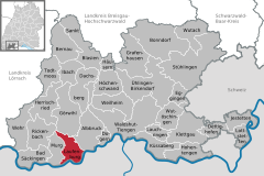
Location of Laufenburg within Waldshut district
(2016–24) Ulrich Krieger[1]
(2022-12-31)[2]
79725
Laufenburg is a town in Baden-Württemberg, Germany, part of the Waldshut district. It has approximately 4300 inhabitants (including 6 outskirts 8300 inhabitants). Laufenburg is separated from a Swiss city with the same name by the river Rhine.
Cities in the near vicinity
- Near surrounding (<15 km): Bad Säckingen, Waldshut-Tiengen, Rickenbach (Hotzenwald), Albbruck, Murg am Hochrhein, Stein AG
- Further away (>15 km): Lörrach, Basel, Brugg, Aarau, Zürich, Schaffhausen, St. Blasien, Todtmoos, Freiburg
City administration
The city of Laufenburg encompasses also Binzgen, Grunholz, Hauenstein, Hochsal, Luttingen, Rhina, Rotzel, Stadenhausen.
Brief history
The city was first noted in 1207. In November 1638 one side of the city was taken by Imperialist forces. The bridge across the Rhine was burned afterwards.
Laufenburg was one city until about 1800 when Napoleon divided the city, ordering that the Rhine should become the border. Ever since the two cities have been separated by nationality. The city was well placed on major rapids of the Rhine, which allowed the town to collect taxes as well as catch salmon. In the early 20th century the rapids were demolished in order to build a hydroelectric power plant.
Bridge construction
In December 2004 a new bridge was opened to the east of the city, replacing the previous bridge which had become too congested, because the roads connecting the bridge were single lane roads but were being used for two way traffic. With the opening of the new bridge a new shopping development was erected to the east of the town.
Its construction was hampered by a major engineering mistake. For reasons of politics and budgets, Switzerland and Germany each constructed half the bridge, rather than one unified contractor doing everything. The half-bridges needed to align precisely on height. Switzerland and Germany use different references for sea-level: the Mediterranean Sea and North Sea respectively. The result is that height above sea level differs by 270 millimetres (0.89 ft) between the two references. This quirk was known to the engineers and they accounted for it, but the calculations made a sign error. Rather than cancelling out this known difference, it instead doubled it to 540 millimetres (1.77 ft).[3][4]
References
- ^ Aktuelle Wahlergebnisse, Staatsanzeiger, accessed 15 September 2021.
- ^ "Bevölkerung nach Nationalität und Geschlecht am 31. Dezember 2022" [Population by nationality and sex as of December 31, 2022] (CSV) (in German). Statistisches Landesamt Baden-Württemberg. June 2023.
- ^ The Metric Maven (30 March 2017). "A Bridge Too Far?". Retrieved 23 December 2022.
- ^ "What Happens To A Bridge When One Side Uses Mediterranean Sea Level And Another The North Sea?". Science 2.0. 2 October 2013. Retrieved 23 December 2022.
External links
- Laufenburg (Baden)
- Laufenburg AG
- Laufenburg
- v
- t
- e
Towns and municipalities in Waldshut (district)
- Albbruck
- Bad Säckingen
- Bernau im Schwarzwald
- Bonndorf im Schwarzwald
- Dachsberg
- Dettighofen
- Dogern
- Eggingen
- Görwihl
- Grafenhausen
- Häusern
- Herrischried
- Höchenschwand
- Hohentengen am Hochrhein
- Ibach
- Jestetten
- Klettgau
- Küssaberg
- Lauchringen
- Laufenburg
- Lottstetten
- Murg
- Rickenbach
- Sankt Blasien
- Stühlingen
- Todtmoos
- Ühlingen-Birkendorf
- Waldshut-Tiengen
- Wehr
- Weilheim
- Wutach
- Wutöschingen

Authority control databases | |
|---|---|
| International |
|
| National |
|
| Other |
|
 | This Waldshut location article is a stub. You can help Wikipedia by expanding it. |
- v
- t
- e


