Latorica
River in Ukraine, Slovakia
48°50′53″N 23°07′47″E / 48.848°N 23.1298°E / 48.848; 23.1298 • location
• coordinates
Ramsar Wetland
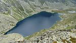
Latorica (Hungarian: Latorca; Slovak: Latorica, pronounced: Latoritsa; Ukrainian: Латориця, translit.: Latorytsia) is a river in the watershed of the Danube. Its source is in the Ukrainian Carpathians (Eastern Carpathian Mountains), near the village Latirka [Wikidata]. It flows from Ukraine (156.6 km) to Slovakia (31.4 km), 188 km in total and west through the towns of Svaliava, Mukachevo, Solomonovo, Chop and Veľké Kapušany. Its basin size is 7,740 km2 (2,990 sq mi).[2] Its confluence with the Ondava, in Zemplín, gives rise to the Bodrog river, itself a tributary of the Tisza.
A part of its watershed (Latorica Protected Landscape Area, "Ramsar site No. 606", 44.05 km2) has been added to the Ramsar list of wetlands of international importance since 1993.
Etymology
It is interpreted differently: according to one hypothesis, it is a pre-Slavic noun, according to others it is related to Slavic, based on lat- "studeny" (meaning "cold river").[3]
References
- ^ "Latorica". Ramsar Sites Information Service. Retrieved 25 April 2018.
- ^ Plán manažmentu povodňového rizikavčiastkovom povodí Bodrogu, p. 51
- ^ Ivan, LUTTERER,Milan MAJTÁN a Rudolf ŠRÁMEK. Zeměpisná jména Československa: Slovník vybraných zeměpisných jmen s výkladem jejich původu a historického vývoje. Praha: Mladá fronta, 1982, page.163
External links
- Ramsar database entry
- v
- t
- e
Hydrography of Slovakia
| Black Sea basin |
| ||||
|---|---|---|---|---|---|
| Baltic Sea basin |
|
| Tarns in Tatra Mountains | |
|---|---|
| Other natural lakes |
|
| Váh basin |
|
|---|---|
| Other |
|
Authority control databases | |
|---|---|
| National |
|
| Other |
|
 | This article about a location in Zakarpattia Oblast is a stub. You can help Wikipedia by expanding it. |
- v
- t
- e
This article related to a river in Ukraine is a stub. You can help Wikipedia by expanding it. |
- v
- t
- e
This article related to a river in Slovakia is a stub. You can help Wikipedia by expanding it. |
- v
- t
- e


