Ladzany
Municipality in Slovakia
48°16′N 18°55′E / 48.267°N 18.917°E / 48.267; 18.917 Slovakia
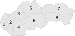
 (2021)
962 67[3]
Ladzany (Hungarian: Ledény) is a village and municipality in the Krupina District of the Banská Bystrica Region of Slovakia.
See also
References
- ^ "Počet obyvateľov podľa pohlavia - obce (ročne)". www.statistics.sk (in Slovak). Statistical Office of the Slovak Republic. 2022-03-31. Retrieved 2022-03-31.
- ^ a b "Hustota obyvateľstva - obce [om7014rr_ukaz: Rozloha (Štvorcový meter)]". www.statistics.sk (in Slovak). Statistical Office of the Slovak Republic. 2022-03-31. Retrieved 2022-03-31.
- ^ a b c d "Základná charakteristika". www.statistics.sk (in Slovak). Statistical Office of the Slovak Republic. 2015-04-17. Retrieved 2022-03-31.
- ^ a b "Hustota obyvateľstva - obce". www.statistics.sk (in Slovak). Statistical Office of the Slovak Republic. 2022-03-31. Retrieved 2022-03-31.
External links
 Media related to Ladzany at Wikimedia Commons
- Official website

- v
- t
- e
Municipalities of Krupina District
- Dudince
- Krupina
- Bzovík
- Cerovo
- Čabradský Vrbovok
- Čekovce
- Devičie
- Dolné Mladonice
- Dolný Badín
- Domaníky
- Drážovce
- Drienovo
- Hontianske Moravce
- Hontianske Nemce
- Hontianske Tesáre
- Horné Mladonice
- Horný Badín
- Jalšovík
- Kozí Vrbovok
- Kráľovce-Krnišov
- Lackov
- Ladzany
- Lišov
- Litava
- Medovarce
- Rykynčice
- Sebechleby
- Selce
- Senohrad
- Súdovce
- Sudince
- Terany
- Trpín
- Uňatín
- Zemiansky Vrbovok
- Žibritov

| Authority control databases: National |
|
|---|
 | This Banská Bystrica Region geography article is a stub. You can help Wikipedia by expanding it. |
- v
- t
- e


