Kouto
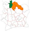
Place in Savanes, Ivory Coast
9°54′N 6°25′W / 9.900°N 6.417°W / 9.900; -6.417 Ivory Coast
 (2021 census)[2]
Kouto is a town in northern Ivory Coast. It is a sub-prefecture of and the seat of Kouto Department in Bagoué Region, Savanes District. Kouto is also a commune. The town is known for its seventeenth century Sahelian mosque, which was inscribed on the UNESCO World Heritage List (along with other nearby mosques) in 2021.[3]
In 2021, the population of the sub-prefecture of Kouto was 55,893.[2]
Villages
The 11 villages of the sub-prefecture of Kouto and their population in 2014 are:[1]
- Boyo (3 791)
- Kouto (10 989)
- Samorossoba (1 421)
- Timboroni (842)
- Nimbiasso (1 722)
- Tabakoroni (1 905)
- Tindara (2 757)
- Tioro (1 148)
- Womon (2 339)
- Wora (5 568)
- Zaguinasso (4 578)
Notes
- ^ a b Citypopulation.de Population of the localities in the sub-prefecture of Kouto
- ^ a b Citypopulation.de
- ^ "Sudanese style mosques in northern Côte d'Ivoire". UNESCO World Heritage Centre. United Nations Educational, Scientific, and Cultural Organization. Retrieved 5 September 2021.
 | This Savanes District location article is a stub. You can help Wikipedia by expanding it. |
- v
- t
- e


