Kefermarkt
Place in Upper Austria, Austria

Coat of arms
(2018-01-01)[2]
4292
Kefermarkt is a municipality in the district of Freistadt in the Austrian state of Upper Austria. The church in Kefermarkt houses the late medieval Kefermarkt Altarpiece.
Population
| Year | Pop. | ±% |
|---|---|---|
| 1869 | 1,441 | — |
| 1880 | 1,527 | +6.0% |
| 1890 | 1,481 | −3.0% |
| 1900 | 1,506 | +1.7% |
| 1910 | 1,604 | +6.5% |
| 1923 | 1,659 | +3.4% |
| 1934 | 1,642 | −1.0% |
| 1939 | 1,614 | −1.7% |
| 1951 | 1,697 | +5.1% |
| 1961 | 1,721 | +1.4% |
| 1971 | 1,798 | +4.5% |
| 1981 | 1,738 | −3.3% |
| 1991 | 1,950 | +12.2% |
| 2001 | 2,056 | +5.4% |
Gallery
-
 View on castle
 -
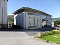
 Railway station
 -
 Pfarrkirche Kefermarkt
 -
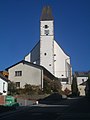 Pfarrkirche Kefermarkt
 -
 Inside of Pfarrkirche Kefermarkt
 -
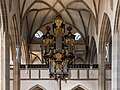 Organ
Organ -
 Guesthouse Gasthaus Zur Goldenen Sense Aussen
 -
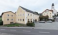
 Kefermarkt evPfarrhof
 -
 Bridge to Schloss Weinberg
 -
 Castle Schloss Weinberg
 -
 Pillory - Schandpfahl, was built in 1479, dismantled in 1738 and it was restored in 1980
 -
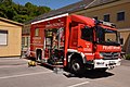 Fire service
 -
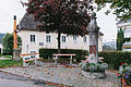
 City hall
 -
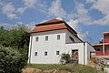
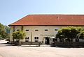 The castle brewery
 -
 View over castle Weinberg to the west


References
Wikimedia Commons has media related to Kefermarkt.
- v
- t
- e
Municipalities in the district of Freistadt
- Bad Zell
- Freistadt
- Grünbach
- Gutau
- Hagenberg im Mühlkreis
- Hirschbach im Mühlkreis
- Kaltenberg
- Kefermarkt
- Königswiesen
- Lasberg
- Leopoldschlag
- Liebenau
- Neumarkt im Mühlkreis
- Pierbach
- Pregarten
- Rainbach im Mühlkreis
- Sandl
- Sankt Leonhard bei Freistadt
- Sankt Oswald bei Freistadt
- Schönau im Mühlkreis
- Tragwein
- Unterweißenbach
- Unterweitersdorf
- Waldburg
- Wartberg ob der Aist
- Weitersfelden
- Windhaag bei Freistadt
Authority control databases | |
|---|---|
| International |
|
| National |
|
| Geographic |
|
 | This Upper Austria location article is a stub. You can help Wikipedia by expanding it. |
- v
- t
- e


