Kang Da Ri Airport
Airport


Kang Da Ri

Kang Da Ri
Kang Da Ri
Kang Da Ri
| Direction | Length | Surface | |
|---|---|---|---|
| ft | m | ||
| 04/22 | 1,560 | 475 | Asphalt |
| Kang Da Ri Airport | |
| Chosŏn'gŭl | 강다리비행장 |
|---|---|
| Hancha | 강다리飛行場 |
| Revised Romanization | Gangdari bihaengjang |
| McCune–Reischauer | Kangdari pihaengjang |
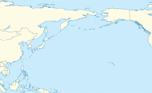
Kang Da Ri Airport is an airport in Wonsan, Kangwon-do, North Korea. It is immediately adjacent to the nearby Kang Da Ri Highway Strip.
Facilities
The airfield has a single asphalt runway 04/22 measuring 1560 x 46 feet (475 x 14 m).[1] It is sited across a river from the Kang Da Ri Highway strip, and recent satellite photos appear to show a bridge connecting the two under construction.[2] The reported runway appears to be on substantial fill and possibly extends through a nearby hill and emerges on the other side. The field is a few miles southwest of Wonsan Airport.
References
- v
- t
- e
- Pyongyang International Airport
- Haeju
- Kalma
- Orang
- Samjiyon
- Sondok
- Changjin
- Chiktong
- Chodo
- Hoeyang Southeast
- Hwangju
- Hwangsuwon
- Hyesan
- Hyon Ni
- Ichon
- Ichon Northeast
- Kaechon
- Kang Da Ri
- Kangdong
- Koksan
- Kuktong
- Kumgang
- Kuum Ni
- Kwail
- Kwaksan
- Kyongsong Chuul
- Maengsan
- Manpo
- Mirim
- Onchon
- Ongjin
- Paegam
- Panghyon
- Pukchang
- Pyongsul Li
- Rihyon
- Riwon
- Sinuiju
- Sohung
- Sonchon
- Sunchon
- Sungam
- Taebukpo
- Taechon
- Taechon Northwest
- Taetan
- Tanchon South
- Toha Ri North
- Toksan
- Uiju
- Unchon Up
- Yonpo
 | This article about an airport in North Korea is a stub. You can help Wikipedia by expanding it. |
- v
- t
- e


