Iraí
Place in South, Brazil

Flag

Seal
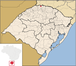
Location in Rio Grande do Sul State
(2020 [1])
Iraí is a municipality in the state of Rio Grande do Sul, Brazil.
Climate
| Climate data for Iraí (1981–2010) | |||||||||||||
|---|---|---|---|---|---|---|---|---|---|---|---|---|---|
| Month | Jan | Feb | Mar | Apr | May | Jun | Jul | Aug | Sep | Oct | Nov | Dec | Year |
| Mean daily maximum °C (°F) | 32.3 (90.1) | 31.8 (89.2) | 31.0 (87.8) | 27.8 (82.0) | 23.6 (74.5) | 22.2 (72.0) | 21.9 (71.4) | 24.6 (76.3) | 25.3 (77.5) | 27.7 (81.9) | 30.2 (86.4) | 31.8 (89.2) | 27.5 (81.5) |
| Daily mean °C (°F) | 25.4 (77.7) | 24.8 (76.6) | 23.8 (74.8) | 20.4 (68.7) | 16.3 (61.3) | 15.3 (59.5) | 14.5 (58.1) | 16.5 (61.7) | 18.2 (64.8) | 21.0 (69.8) | 23.0 (73.4) | 24.8 (76.6) | 20.3 (68.5) |
| Mean daily minimum °C (°F) | 20.0 (68.0) | 19.7 (67.5) | 18.6 (65.5) | 15.5 (59.9) | 11.9 (53.4) | 10.9 (51.6) | 9.8 (49.6) | 11.0 (51.8) | 12.9 (55.2) | 15.9 (60.6) | 16.8 (62.2) | 19.1 (66.4) | 15.2 (59.4) |
| Average precipitation mm (inches) | 162.2 (6.39) | 187.3 (7.37) | 120.1 (4.73) | 157.6 (6.20) | 163.2 (6.43) | 159.1 (6.26) | 144.5 (5.69) | 129.6 (5.10) | 175.5 (6.91) | 240.7 (9.48) | 152.0 (5.98) | 160.2 (6.31) | 1,952 (76.9) |
| Average precipitation days (≥ 1.0 mm) | 11 | 11 | 9 | 9 | 7 | 9 | 8 | 7 | 10 | 12 | 9 | 9 | 111 |
| Average relative humidity (%) | 70.7 | 74.3 | 74.9 | 78.5 | 82.7 | 84.0 | 81.0 | 76.0 | 73.5 | 73.8 | 70.2 | 68.9 | 75.7 |
| Mean monthly sunshine hours | 238.2 | 196.3 | 212.9 | 178.9 | 155.3 | 125.4 | 153.7 | 161.2 | 147.6 | 176.5 | 218.0 | 233.3 | 2,197.3 |
| Source: Instituto Nacional de Meteorologia[2] | |||||||||||||
See also
- v
- t
- e

Capital: Porto Alegre
Mesoregion Centro Ocidental Rio-Grandense | |||||||
|---|---|---|---|---|---|---|---|
| |||||||

Mesoregion Metropolitana de Porto Alegre | |||||||||||||
|---|---|---|---|---|---|---|---|---|---|---|---|---|---|
| |||||||||||||
Mesoregion Nordeste Rio-Grandense | |||||||
|---|---|---|---|---|---|---|---|
| |||||||
Mesoregion Noroeste Rio-Grandense | |||||||||||||||||||||||||||
|---|---|---|---|---|---|---|---|---|---|---|---|---|---|---|---|---|---|---|---|---|---|---|---|---|---|---|---|
| |||||||||||||||||||||||||||
Mesoregion Sudeste Rio-Grandense | |||||||||
|---|---|---|---|---|---|---|---|---|---|
| |||||||||
Mesoregion Sudoeste Rio-Grandense | |||||||
|---|---|---|---|---|---|---|---|
| |||||||
References
Wikimedia Commons has media related to Iraí.
Authority control databases | |
|---|---|
| International |
|
| National |
|
 | This geographical article relating to Rio Grande do Sul is a stub. You can help Wikipedia by expanding it. |
- v
- t
- e


