Harrity, Pennsylvania
Village in Pennsylvania, U.S.


Harrity, Pennsylvania
class=notpageimage|
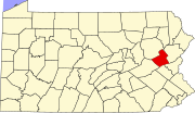
Location of Harrity within the state of PennsylvaniaHarrity is a village in Franklin Township, Carbon County, Pennsylvania on the Pohopoco Creek, which flows westward from Beltzville Lake into the Lehigh River to the south of the village in Parryville. U.S. Route 209 forms the southern boundary and meets Interstate 476, which forms the western boundary, at the Mahoning Valley Interchange in Harrity. It serves as the gateway to Beltzville State Park from the west and the NE Extension (I-476). It uses the Lehighton zip code of 18235.
Neighboring communities
References
See also
- v
- t
- e
Municipalities and communities of Carbon County, Pennsylvania, United States
County seat: Jim Thorpe
- Beaver Meadows
- Bowmanstown
- East Side
- Jim Thorpe
- Lansford
- Lehighton
- Nesquehoning
- Palmerton
- Parryville
- Summit Hill
- Weatherly
- Weissport

communities
‡This populated place also has portions in an adjacent county or counties
- Pennsylvania portal
- United States portal
40°50′24″N 75°40′04″W / 40.84000°N 75.66778°W / 40.84000; -75.66778
 | This Carbon County, Pennsylvania state location article is a stub. You can help Wikipedia by expanding it. |
- v
- t
- e


