Haimchar Upazila
Upazila in Chittagong, Bangladesh
Haimchar হাইমচর | |
|---|---|
Upazila | |
 | |
| Coordinates: 23°4′N 90°38.3′E / 23.067°N 90.6383°E / 23.067; 90.6383 | |
| Country |  Bangladesh Bangladesh |
| Division | Chittagong |
| District | Chandpur |
| Government | |
| Area | |
| • Total | 134.16 km2 (51.80 sq mi) |
| Population (2011) | |
| • Total | 109,575 |
| • Density | 820/km2 (2,100/sq mi) |
| Time zone | UTC+6 (BST) |
| Website | Official Map of Haimchar |
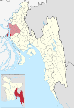
Haimchar (Bengali: হাইমচর) is an upazila of Chandpur District[1] in the Division of Chittagong, Bangladesh.
Geography
Haimchar is located at 23°04′00″N 90°38′15″E / 23.0667°N 90.6375°E / 23.0667; 90.6375. It has a total area of 134.16 km2.
Demographics
| Religions in Haimchar upazila (2011)[2] | ||||
|---|---|---|---|---|
| Religion | Percent | |||
| Islam | 95.70% | |||
| Hinduism | 4.26% | |||
| Other or not stated | 0.04% | |||
According to the 2011 Bangladesh census, Haimchar Upazila had 24,903 households and a population of 109,575. 28,239 (25.77%) were under 10 years of age. Haimchar had a literacy rate (age 7 and over) of 48.13%, compared to the national average of 51.8%, and a sex ratio of 1042 females per 1000 males. 8,847 (8.07%) lived in urban areas.[3][2]
According to the 1991 Bangladesh census, Haimchar had a population of 113,306. Males constituted 51.29% of the population, and females 48.71%. The population aged 18 or over was 52,033. Haimchar had an average literacy rate of 25.4% (7+ years), compared to the national average of 32.4%.[4]
Administration
Haimchar Upazila is divided into six union parishads: Char Bhairabi, Dakshin Algi Durgapur, Gazipur, Haimchar, Nilkamal, and Uttar Algi Durgapur. The union parishads are subdivided into 27 mauzas and 65 villages.[5]
See also
References
- ^ Md. Mahbubur Rahman (2012), "Haimchar Upazila", in Sirajul Islam and Ahmed A. Jamal (ed.), Banglapedia: National Encyclopedia of Bangladesh (Second ed.), Asiatic Society of Bangladesh
- ^ a b "Bangladesh Population and Housing Census 2011 Zila Report – Chandpur" (PDF). bbs.gov.bd. Bangladesh Bureau of Statistics.
- ^ "Community Tables: Chandpur district" (PDF). bbs.gov.bd. 2011.
- ^ "Population Census Wing, BBS". Archived from the original on 2005-03-27. Retrieved November 10, 2006.
- ^ "District Statistics 2011: Chandpur" (PDF). Bangladesh Bureau of Statistics. Archived from the original (PDF) on 13 November 2014. Retrieved 14 July 2014.
- v
- t
- e


 | This Chittagong Division location article is a stub. You can help Wikipedia by expanding it. |
- v
- t
- e


