Flaurling
Place in Tyrol, Austria

Coat of arms
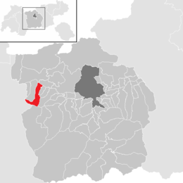
Location in the district
(2018-01-01)[2]
6403
Flaurling is a municipality in the district Innsbruck country in Tyrol (Austria). It lies in the Inn valley between Innsbruck and Telfs south of the Inn River.
The municipality consists of the areas: Flaurling village, Flaurling station with a commercial district and Flaurlingberg at the western foothills of a low mountain range terrace. It was mentioned documentarily for the first time as "Flurininga" in the year 763.
Population
| Year | Pop. | ±% |
|---|---|---|
| 1869 | 556 | — |
| 1880 | 542 | −2.5% |
| 1890 | 517 | −4.6% |
| 1900 | 441 | −14.7% |
| 1910 | 493 | +11.8% |
| 1923 | 531 | +7.7% |
| 1934 | 583 | +9.8% |
| 1939 | 578 | −0.9% |
| 1951 | 701 | +21.3% |
| 1961 | 712 | +1.6% |
| 1971 | 884 | +24.2% |
| 1981 | 908 | +2.7% |
| 1991 | 976 | +7.5% |
| 2001 | 1,106 | +13.3% |
| 2011 | 1,224 | +10.7% |
| 2015 | 1,285 | +5.0% |
Twin towns
 Andocs, Hungary

References
External links
- Town History (German)
Wikimedia Commons has media related to Flaurling.
- v
- t
- e
Municipalities in the district of Innsbruck-Land
- Absam
- Aldrans
- Ampass
- Axams
- Baumkirchen
- Birgitz
- Ellbögen
- Flaurling
- Fritzens
- Fulpmes
- Gnadenwald
- Götzens
- Gries am Brenner
- Gries im Sellrain
- Grinzens
- Gschnitz
- Hall in Tirol
- Hatting
- Inzing
- Kematen in Tirol
- Kolsass
- Kolsassberg
- Lans
- Leutasch
- Matrei am Brenner
- Mieders
- Mils
- Mutters
- Natters
- Navis
- Neustift im Stubaital
- Oberhofen im Inntal
- Obernberg am Brenner
- Oberperfuss
- Patsch
- Pettnau
- Pfaffenhofen
- Polling in Tirol
- Ranggen
- Reith bei Seefeld
- Rinn
- Rum
- St. Sigmund im Sellrain
- Scharnitz
- Schmirn
- Schönberg im Stubaital
- Seefeld in Tirol
- Sellrain
- Sistrans
- Steinach am Brenner
- Telfes
- Telfs
- Thaur
- Trins
- Tulfes
- Unterperfuss
- Vals
- Volders
- Völs
- Wattenberg
- Wattens
- Wildermieming
- Zirl

Authority control databases | |
|---|---|
| International |
|
| National |
|


