Dungannon Upper
Barony in County Tyrone, Northern Ireland
Place in Northern Ireland, United Kingdom
Dungannon Upper Dún Geanainn Uachtarach[1] (Irish) | |
|---|---|
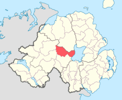 Location of Dungannon Upper, County Tyrone, Northern Ireland. | |
54°39′09″N 6°45′17″W / 54.6525°N 6.7548°W / 54.6525; -6.7548 | |
| Sovereign state | United Kingdom |
| Country | Northern Ireland |
| County | Tyrone |
Dungannon Upper is a barony in County Tyrone, Northern Ireland.[2] It was created in 1851 with the splitting of the barony of Dungannon.[3] Lough Neagh runs along its eastern boundary, and it is bordered by four other baronies: Dungannon Middle to the south; Loughinsholin to the north; Strabane Upper to the north-west; and Omagh East to the south-west.[2]
List of main settlements
- Ardboe
- Coagh
- Cookstown
- Tullyhogue
List of civil parishes
Below is a list of civil parishes in Dungannon Upper:[4]
- Arboe (split with barony of Loughinsholin)
- Artrea (split with barony of Loughinsholin)
- Ballinderry (split with barony of Loughinsholin)
- Ballyclog
- Derryloran (split with barony of Loughinsholin)
- Desertcreat
- Kildress
- Lissan (also partly in barony of Loughinsholin)
- Tamlaght (split with barony of Loughinsholin)
References
- ^ "Dungannon Upper". Placenames Database of Ireland. Department of Community, Rural and Gaeltacht Affairs. Retrieved 4 December 2012.
- ^ a b PRONI Baronies of Northern Ireland
- ^ "Notes on Baronies of Ireland 1821-1891, page 14" (PDF). Archived from the original (PDF) on 12 March 2016. Retrieved 8 October 2010.
- ^ "PRONI Parishes of County Tyrone". Archived from the original on 27 July 2011. Retrieved 15 July 2010.
- v
- t
- e
Places in County Tyrone
and townlands
- Altamuskin
- Altishane
- Altmore
- Ardboe
- Ardstraw
- Artigarvan
- Augher
- Aughnacloy
- Ballygawley
- Ballymagorry
- Ballymully Glebe
- Benburb
- Beragh
- Blackwatertown
- Brackaville
- Bready
- Brockagh
- Caledon
- Cappagh
- Carnteel
- Carrickmore
- Castlecaulfield
- Castlederg
- Clady
- Clanabogan
- Clogher
- Coagh
- Cranagh
- Creggan
- Derrycrin
- Derrylaughan
- Derrytresk
- Donaghmore
- Dooish
- Douglas Bridge
- Dromore
- Drumkee
- Drumnakilly
- Drumquin
- Dunnamanagh
- Dunnamore
- Edenderry
- Eglish
- Erganagh
- Eskra
- Evish
- Fintona
- Fivemiletown
- Galbally
- Garvaghey
- Garvetagh
- Gillygooly
- Glebe
- Glenmornan
- Gortaclare
- Gortin
- Granville
- Greencastle
- Kildress
- Killay
- Killen
- Killeter
- Killyclogher
- Killyman
- Kilskeery
- Knockmoyle
- Landahaussy
- Liscloon
- Loughmacrory
- Magheramason
- Moortown
- Mountfield
- Moy
- Moygashel
- Moylagh
- Mullaghmore
- Newmills
- Newtownstewart
- Plumbridge
- Pomeroy
- Rock
- Rousky
- Sandholes
- Seskinore
- Shanmaghery
- Sion Mills
- Sixmilecross
- Spamount
- Stewartstown
- Tamnamore
- Tattyreagh
- Trillick
- Tullyhogue
- Tullyvannon
- Tullywiggan
- Victoria Bridge
- Washing Bay
- Clogher
- Dungannon Lower
- Dungannon Middle
- Dungannon Upper
- Omagh East
- Omagh West
- Strabane Lower
- Strabane Upper
- WikiProject Northern Ireland
- WikiProject Ireland
- Northern Ireland Portal
- United Kingdom Portal
- Ireland Portal


