Drogenbos
Municipality in Flemish Community, Belgium

Flag

Coat of arms
Location of Drogenbos


Drogenbos
Location in Belgium 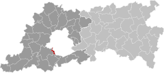
Location of Drogenbos in Flemish Brabant

 Belgium
 (2018-01-01)[1]
1620
23098
Drogenbos (Dutch pronunciation: [ˈdroːɣə(n)bɔs] ⓘ; French pronunciation: [dʁoɡənbɔs]) is a municipality located in the Belgian province of Flemish Brabant. The municipality only comprises the town of Drogenbos proper. On January 1, 2018, Drogenbos had a total population of 5,599. The total area is 2.49 km2 (0.96 sq mi) which gives a population density of 2,248 inhabitants per km2 (5,701/sq mi).
The official language of Drogenbos is Dutch, as everywhere in Flanders. Local French-speakers (77% of the population) enjoy linguistic facilities.
Famous inhabitants
- Joseph Loeckx, comic artist, pseudonym Jo-El Azara
- Charles Theodore, Elector of Bavaria, Duke of Bavaria
- Felix De Boeck (1898 - 1995), painter. A museum [2] has been opened in 1995 with the work of Felix De Boeck.
References
External links
 Media related to Drogenbos at Wikimedia Commons
- Official website – information available in Dutch and French
Places adjacent to Drogenbos | ||||||||||||||||
|---|---|---|---|---|---|---|---|---|---|---|---|---|---|---|---|---|
| ||||||||||||||||


- v
- t
- e
- Affligem
- Asse
- Beersel
- Bever
- Dilbeek
- Drogenbos
- Galmaarden
- Gooik
- Grimbergen
- Halle
- Herne
- Hoeilaart
- Kampenhout
- Kapelle-op-den-Bos
- Kraainem
- Lennik
- Liedekerke
- Linkebeek
- Londerzeel
- Machelen
- Meise
- Merchtem
- Opwijk
- Overijse
- Pepingen
- Roosdaal
- Sint-Genesius-Rode
- Sint-Pieters-Leeuw
- Steenokkerzeel
- Ternat
- Vilvoorde
- Wemmel
- Wezembeek-Oppem
- Zaventem
- Zemst

- Bold indicates cities
- Italic indicates municipalities with language facilities
Authority control databases | |
|---|---|
| International |
|
| National |
|
| Geographic |
|
 | This Flemish Brabant location article is a stub. You can help Wikipedia by expanding it. |
- v
- t
- e


