Crossing Knob

Crossing Knob
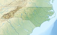
Location in North Carolina
Crossing Knob is a mountain in the North Carolina High Country, west from the community of Sugar Grove. The mountain is within the Pisgah National Forest and its elevation reaches 3,340 feet (1,018 m). The mountain is flanked by the Watauga River on three sides and US 321 along its south.
References
- ^ a b "Crossing Knob". Geographic Names Information System. United States Geological Survey, United States Department of the Interior. Retrieved 2011-09-10.
- v
- t
- e
| Bald Mountains |
|
|---|---|
| Black Mountains |
|
| Brushy Mountains | |
| Great Balsam Mountains |
|
| Great Craggy Mountains | |
| Great Smoky Mountains | |
| Plott Balsams | |
| Unaka Range |
|
| Unicoi Mountains | |
| Iron Mountains |
|
| Others |
|
- Moore's Knob
- Pilot Mountain
- Albert Mountain
- Big Butt Mountain
- Cane Creek Mountains
- Crowders Mountain
- Devil's Courthouse
- Kings Pinnacle
- Looking Glass Rock
- Mayfield Mountain
- McAlpine Mountain
- Mount Jefferson
- Mulatto Mountain
- Occoneechee Mountain
- Old Butt Knob
- South Mountains
- Standing Indian Mountain
- Terrells Mountain
- Wayah Bald
- Wesser Bald
- Whiteside Mountain
This article about a location in Watauga County, North Carolina is a stub. You can help Wikipedia by expanding it. |
- v
- t
- e
 | This article related to a mountain, mountain range, or peak in the United States is a stub. You can help Wikipedia by expanding it. |
- v
- t
- e


