Cottonwoods, Manitoba
Place in Manitoba, Canada
49°50′59″N 99°42′0″W / 49.84972°N 99.70000°W / 49.84972; -99.70000 Canada
 Manitoba
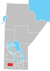
Cottonwoods is an unincorporated community in southwestern Manitoba, Canada. It is located in the Rural Municipality of Cornwallis, approximately 18 kilometers (11 miles) east of Brandon.[1]
References
- ^ "Geographical Names of Canada - Querying Distances". nrcan.gc.ca. October 24, 2011. Archived from the original on April 10, 2013. Retrieved March 17, 2013.
- v
- t
- e
| Former towns |
|---|
| Former villages |
|---|
| Former RMs |
|---|
 | This Manitoba location article is a stub. You can help Wikipedia by expanding it. |
- v
- t
- e


