Carcoforo
Comune in Piedmont, Italy
Location of Carcoforo

45°54′N 8°3′E / 45.900°N 8.050°E / 45.900; 8.050
(31 May 2017)[2]
13026
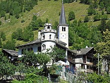
Carcoforo is a comune (municipality) in the province of Vercelli in the Italian region Piedmont, located about 100 kilometres (62 mi) northeast of Turin and about 70 kilometres (43 mi) northwest of Vercelli.
Carcoforo borders the following municipalities: Alto Sermenza, Bannio Anzino, Ceppo Morelli, Fobello and Macugnaga.
References
- v
- t
- e
- Alagna Valsesia
- Albano Vercellese
- Alice Castello
- Alto Sermenza
- Arborio
- Asigliano Vercellese
- Balmuccia
- Balocco
- Bianzè
- Boccioleto
- Borgo Vercelli
- Borgo d'Ale
- Borgosesia
- Buronzo
- Campertogno
- Carcoforo
- Caresana
- Caresanablot
- Carisio
- Casanova Elvo
- Cellio con Breia
- Cervatto
- Cigliano
- Civiasco
- Collobiano
- Costanzana
- Cravagliana
- Crescentino
- Crova
- Desana
- Fobello
- Fontanetto Po
- Formigliana
- Gattinara
- Ghislarengo
- Greggio
- Guardabosone
- Lamporo
- Lenta
- Lignana
- Livorno Ferraris
- Lozzolo
- Mollia
- Moncrivello
- Motta de' Conti
- Olcenengo
- Oldenico
- Palazzolo Vercellese
- Pertengo
- Pezzana
- Pila
- Piode
- Postua
- Prarolo
- Quarona
- Quinto Vercellese
- Rassa
- Rimella
- Rive
- Roasio
- Ronsecco
- Rossa
- Rovasenda
- Salasco
- Sali Vercellese
- Saluggia
- San Germano Vercellese
- San Giacomo Vercellese
- Santhià
- Scopa
- Scopello
- Serravalle Sesia
- Stroppiana
- Tricerro
- Trino
- Tronzano Vercellese
- Valduggia
- Varallo Sesia
- Vercelli
- Villarboit
- Villata
- Vocca
| Authority control databases |
|
|---|
 | This article on a location in the Province of Vercelli is a stub. You can help Wikipedia by expanding it. |
- v
- t
- e


