Bargstedt, Lower Saxony
Municipality in Lower Saxony, Germany

Coat of arms
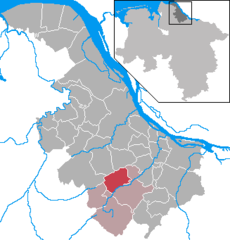
Location of Bargstedt within Stade district
53°27′39″N 09°26′55″E / 53.46083°N 9.44861°E / 53.46083; 9.44861
(2022-12-31)[1]
21698
Bargstedt is a municipality in the district of Stade, Lower Saxony, Germany.
It belonged to the Prince-Archbishopric of Bremen. In 1648 the Prince-Archbishopric was transformed into the Duchy of Bremen, which was first ruled in personal union by the Swedish and from 1715 on by the Hanoverian Crown. In 1823 the Duchy was abolished and its territory became part of the Stade Region.
References
- ^ "LSN-Online Regionaldatenbank, Tabelle A100001G: Fortschreibung des Bevölkerungsstandes, Stand 31. Dezember 2022" (in German). Landesamt für Statistik Niedersachsen.
- v
- t
- e
Towns and municipalities in Stade (district)
- Agathenburg
- Ahlerstedt
- Apensen
- Balje
- Bargstedt
- Beckdorf
- Bliedersdorf
- Brest
- Burweg
- Buxtehude
- Deinste
- Dollern
- Drochtersen
- Düdenbüttel
- Engelschoff
- Estorf
- Fredenbeck
- Freiburg
- Großenwörden
- Grünendeich
- Guderhandviertel
- Hammah
- Harsefeld
- Heinbockel
- Himmelpforten
- Hollern-Twielenfleth
- Horneburg
- Jork
- Kranenburg
- Krummendeich
- Kutenholz
- Mittelnkirchen
- Neuenkirchen
- Nottensdorf
- Oederquart
- Oldendorf
- Sauensiek
- Stade
- Steinkirchen
- Wischhafen

Authority control databases | |
|---|---|
| International |
|
| National |
|
 | This Stade (district) location article is a stub. You can help Wikipedia by expanding it. |
- v
- t
- e


