Arvier
Comune in Aosta Valley, Italy

Coat of arms
Location of Arvier

45°42′11″N 7°10′0″E / 45.70306°N 7.16667°E / 45.70306; 7.16667
(31 December 2022)[2]
11011
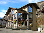
Arvier (Valdôtain: Arvì or Arvë; Arpitan: Arviér); is a town and comune in the Aosta Valley region of northwestern Italy.
Geography

Wine
The local wine, Enfer d'Arvier, had its own DOC designation before being subsumed into the Valle d'Aosta DOC. It is a blend made primarily from the Petit Rouge grape with lesser amounts of Dolcetto, Gamay, Neyret, Pinot noir, and/or Vien de Nus.[3]
People
Arvier was the birthplace of Maurice Garin, the winner of the original Tour de France in 1903. His family migrated to Northern France in 1885.
Notes and references
- ^ "Superficie di Comuni Province e Regioni italiane al 9 ottobre 2011". Italian National Institute of Statistics. Retrieved 16 March 2019.
- ^ "Popolazione Residente al 1° Gennaio 2018". Italian National Institute of Statistics. Retrieved 16 March 2019.
- ^ T. Stevenson "The Sotheby's Wine Encyclopedia" p. 274 Dorling Kindersley 2005 ISBN 0-7566-1324-8
- v
- t
- e
- Allein
- Antey-Saint-André
- Aosta
- Arnad
- Arvier
- Avise
- Ayas
- Aymavilles
- Bard
- Bionaz
- Brissogne
- Brusson
- Challand-Saint-Anselme
- Challand-Saint-Victor
- Chambave
- Chamois
- Champdepraz
- Champorcher
- Charvensod
- Châtillon
- Cogne
- Courmayeur
- Donnas
- Doues
- Émarèse
- Étroubles
- Fontainemore
- Fénis
- Gaby
- Gignod
- Gressan
- Gressoney-La-Trinité
- Gressoney-Saint-Jean
- Hône
- Introd
- Issime
- Issogne
- Jovençan
- La Magdeleine
- La Salle
- La Thuile
- Lillianes
- Montjovet
- Morgex
- Nus
- Ollomont
- Oyace
- Perloz
- Pollein
- Pont-Saint-Martin
- Pontboset
- Pontey
- Pré-Saint-Didier
- Quart
- Rhêmes-Notre-Dame
- Rhêmes-Saint-Georges
- Roisan
- Saint-Christophe
- Saint-Denis
- Saint-Marcel
- Saint-Nicolas
- Saint-Oyen
- Saint-Pierre
- Saint-Rhémy-en-Bosses
- Saint-Vincent
- Sarre
- Torgnon
- Valgrisenche
- Valpelline
- Valsavarenche
- Valtournenche
- Verrayes
- Verrès
- Villeneuve

| Authority control databases |
|
|---|
 | This article on a location in Aosta Valley is a stub. You can help Wikipedia by expanding it. |
- v
- t
- e


