Antelope Fire
2021 wildfire in California


Location in California
The Antelope Fire was a wildfire that burned in the Klamath National Forest, the Modoc National Forest, the Shasta-Trinity National Forest, and in Lava Beds National Monument in Siskiyou County, California, in the United States. The fire was started by a lightning strike and was first reported on August 1, 2021. As of October 15, the fire had burned 145,632 acres (58,935 ha).
Progression
August
The Antelope Fire was first reported in the drainage of Antelope Creek in the Goosenest Ranger District of the Klamath National Forest in Siskiyou County, California, on August 1, 2021, around 10:30 AM. The fire was one of many started by lightning strikes in the area during a thunderstorm.[1] The fire was fueled by ponderosa pine and mixed conifer. On August 3, the communities of Bray, Tennant, and Antelope Creek were evacuated due to the fire.[2] The fire spread through the Antelope Creek drainage, growing to 2,700 acres (1,093 ha) by the end of the day.[3] On August 4, a temporary flight restriction was put in place for the fire area.[4] Overnight, red flag warning conditions enabled the fire to grow to over 20,000 acres (8,094 ha). The fire burned around the town of Tennant and threatened the community of Antelope Creek. Additional evacuation orders were put in place for Mount Hebron and areas of Round Valley later in the day.[5] On August 5, Governor Gavin Newsom declared a state of emergency due to the Antelope Fire.[6]
Overnight from August 5 to the morning of the 6th, the fire exhibited extreme fire behavior, including flame lengths over 100 feet. The fire pushed east toward Garner Mountain as fire crews worked to further protect Tennant, Bray and Shasta Wood.[7] By August 7, the fire was 20 percent contained and had started burning in Shasta-Trinity National Forest. Evacuation orders were extended to Shasta Wood and Duck Lake and the communities of Medicine Lake, Payne Springs, and Blanche Lake were place under evacuation warnings. The Forest Service also closed the forest area in and around the fire.[8] The fire was 24 percent contained at 41,958 acres (16,980 ha) by August 8. An evacuation warning for Red Rock Road was put in place and the evacuation center in Dorris was moved to Yreka, California. A 20-30 acre spot fire crossed the control line on the eastern perimeter near Garner Mountain, which was contained as soon as possible by firefighters.[9][10] As of August 25, the fire had burned 69,700 acres (28,207 ha) and was 37 percent contained.[10]
September
Fire activity remained minimal until September 8, when extreme fire behavior occurred under a red flag warning.[11] Over the next week, the fire pushed into the Lava Beds National Monument and behind Sheepy Ridge, effectively doubling in size. After the red flag warning was lifted, the fire showed no significant fire growth.
October
The rugged terrain in the fire zone made containment a slow process. Crews focused on using handlines, dozer lines, and defensive burning to minimize fire spread, protect timber resources, and minimize the fire's impact on the landscape. On October 15, the Antelope Fire was 100% contained.
Effects
Closures
Portions of Klamath National Forest were closed through November 25, 2021, due to the fire.[12]
Environment
Air quality was impacted in the region surrounding the fire. Ash was reported as "blanketing cars" and smoke "choking the air" in the Klamath Basin.[13] In early August, smoke and ash from the fire reached the Bootleg Fire in Oregon, which helped to curb the Bootleg's growth.[14]
Recreation and tourism
Like many fires burning during the 2021 California wildfire season, the Antelope Fire deeply impacted recreational and tourism activities in the area. On August 7, the forest service closed Klamath National Forest due to the Antelope and nearby Tennant Fire. The closure was lifted on November 25, 2021.[12]
Gallery
-
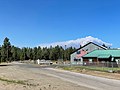
 The Antelope Fire on August 4, 2021.
 -
 The fire seen from McCloud, California, on August 4, 2021.
 -
 A smoke plume erupts on August 5, 2021.
 -
 A backfire set by firefighters in Fish Camp on August 5, 2021.
 -
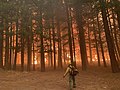 A firefighter watches impeding flames on August 7, 2021.
 -
 A deer grazes in the burn zone near Tennant on August 8, 2021.


References
![]() This article incorporates public domain material from websites or documents of the United States Forest Service.
This article incorporates public domain material from websites or documents of the United States Forest Service.
- ^ a b "Antelope Fire". InciWeb. Archived from the original on 5 August 2021. Retrieved 4 October 2021.
- ^ "Antelope Fire Update 08.03.2021". InciWeb. Retrieved 7 August 2021.[permanent dead link]
- ^ "Antelope Fire - Update 8/3, 4:30 PM". InciWeb. Retrieved 7 August 2021.[permanent dead link]
- ^ "Southwest Incident Management Team 4 assumes command of Antelope Fire". InciWeb. Retrieved 7 August 2021.[permanent dead link]
- ^ "Extreme fire conditions push Antelope Fire to nearly 21,000 acres". InciWeb. Retrieved 7 August 2021.[permanent dead link]
- ^ Rodriguez, Tristi; Zavala, Ashley (6 August 2021). "Newsom declares state of emergency as wildfires grow in Northern CA". KRON4. Archived from the original on 7 August 2021. Retrieved 7 August 2021.
- ^ "Firefighters defend communities from the Antelope Fire". InciWeb. Retrieved 7 August 2021.[permanent dead link]
- ^ "Antelope Fire containment lines hold, increase to 20%". InciWeb. Retrieved 7 August 2021.[permanent dead link]
- ^ "Antelope Fire resources cooperate to increase containment". InciWeb. Retrieved 9 August 2021.[permanent dead link]
- ^ a b "Antelope Fire crews continue to strengthen containment lines". InciWeb. Retrieved 9 August 2021.[permanent dead link]
- ^ "Antelope Fire Update for September 9, 2021". InciWeb. Archived from the original on 21 October 2021. Retrieved 20 October 2021.
- ^ a b "Tennant Fire and Antelope Fire Closure - InciWeb the Incident Information System". InciWeb. United States Forest Service. Archived from the original on 7 August 2021. Retrieved 7 August 2021.
- ^ Gailey, Brian (4 August 2021). "Antelope Fire brings smoke and ash to basin". Klamath Falls News. Archived from the original on 7 August 2021. Retrieved 7 August 2021.
- ^ "Smoke from California wildfire helps limit Bootleg Fire growth". KATU. 5 August 2021. Archived from the original on 6 August 2021. Retrieved 7 August 2021.
External links
 California portal

Wikimedia Commons has media related to Antelope Fire.
- "Rock slide on 299 blocks main road for fighting the Monument Fire" from KRCR
- v
- t
- e
- Canada
- Mexico
- United States
| |
|---|---|
| Pre-2000 |
|
| 2000 | |
| 2001 | |
| 2002 | |
| 2003 | |
| 2004 | |
| 2005 | |
| 2006 | |
| 2007 | |
| 2008 |
|
| 2009 | |
| 2010 | |
| 2011 | |
| 2012 | |
| 2013 | |
| 2014 | |
| 2015 | |
| 2016 | |
| 2017 | |
| 2018 | |
| 2019 | |
| 2020 |
|
| 2021 |
|
| 2022 | |
| 2023 | |
| |


