Annecy – Haute-Savoie – Mont Blanc Airport
Airport in Meythet, France

LFLP
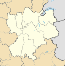
Location of airport in the Rhône-Alpes region
| Direction | Length | Surface | |
|---|---|---|---|
| m | ft | ||
| 04/22 | 1,630 | 5,348 | Asphalt |
Source: French AIP[1]
Annecy – Haute-Savoie – Mont Blanc Airport or Aéroport Annecy Haute-Savoie Mont Blanc (IATA: NCY, ICAO: LFLP), also known as Aéroport d'Annecy - Meythet, is an airport located 3.5 km northwest of Annecy,[1] between Meythet and Metz-Tessy, all communes of the Haute-Savoie département in the Rhône-Alpes région of France.
Airlines and destinations
No destinations served at present.
Statistics
Graphs are unavailable due to technical issues. There is more info on Phabricator and on MediaWiki.org. |
Annual passenger traffic at NCY airport. See Wikidata query.
References
- ^ a b LFLP – Annecy Meythet. AIP from French Service d'information aéronautique, effective 16 May 2024.
External links
- Aéroport Annecy Haute-Savoie Mont Blanc Archived 2009-06-11 at the Wayback Machine (official site) (in French)
- Aéroport d'Annecy - Haute Savoie (Union des Aéroports Français) (in French)
- Current weather for LFLP at NOAA/NWS
- Accident history for NCY at Aviation Safety Network
- v
- t
- e
- Abbeville
- Agen
- Albert Picardie
- Alpe d'Huez
- Angers
- Angoulême
- Annecy
- Aubenas
- Auxerre
- Avignon
- Barcelonnette
- Bourg
- Bourges
- Calais
- Cannes
- Chalon-sur-Saone
- Châteauroux
- Cherbourg
- Colmar
- Courchevel
- Dijon
- Dinard
- Épinal
- Gap
- Hazebrouck
- Lannion
- Le Havre
- Le Touquet
- Lyon–Bron
- Megève
- Méribel
- Montluçon
- Morlaix
- Moulins
- Nancy-Essey
- Orléans
- Paris–Le Bourget
- Périgueux
- Pontoise
- Quimper
- Rouen
- Royan
- Saint-Brieuc
- Saint-Étienne
- Saint-Inglevert
- Saint-Yan
- Toussus-le-Noble
- Troyes
- Valence
- Villefranche
 | This Haute-Savoie geographical article is a stub. You can help Wikipedia by expanding it. |
- v
- t
- e
 | This French airport-related article is a stub. You can help Wikipedia by expanding it. |
- v
- t
- e


