Anaurilândia
Municipality in Central-West, Brazil

Flag

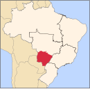
Location in Mato Grosso do Sul state
(2020[1])
Anaurilândia is a municipality located in the Brazilian state of Mato Grosso do Sul. Its population is 9,076 (2020) and its area is 3,396 km². The town was founded by Jan Antonín Baťa as part of his expansion of the Bata shoe company, founded by his brother Tomáš.[2]
Other towns in Brazil linked to Baťa include Mariápolis, Batatuba, Bataguassu, and Batayporã.
Anaurilândia is a small settlement surrounded by agricultural land and lies on the north side of the Rio Parana. MS-395 is a paved single-lane highway that passes through the town and connects it to Batayporã.[citation needed]
References
- v
- t
- e
Capital: Campo Grande
Centro Norte de Mato Grosso do Sul
| Alto Taquari | |
|---|---|
| Campo Grande |
|

Leste de Mato Grosso do Sul
| Cassilândia | |
|---|---|
| Nova Andradina |
|
| Paranaíba | |
| Três Lagoas |
Pantanal Sul Mato-Grossense
| Aquidauana | |
|---|---|
| Baixo Pantanal |
Sudoeste de Mato Grosso do Sul
| Bodoquena | |
|---|---|
| Dourados | |
| Iguatemi |
 | This Mato Grosso do Sul, Brazil location article is a stub. You can help Wikipedia by expanding it. |
- v
- t
- e


